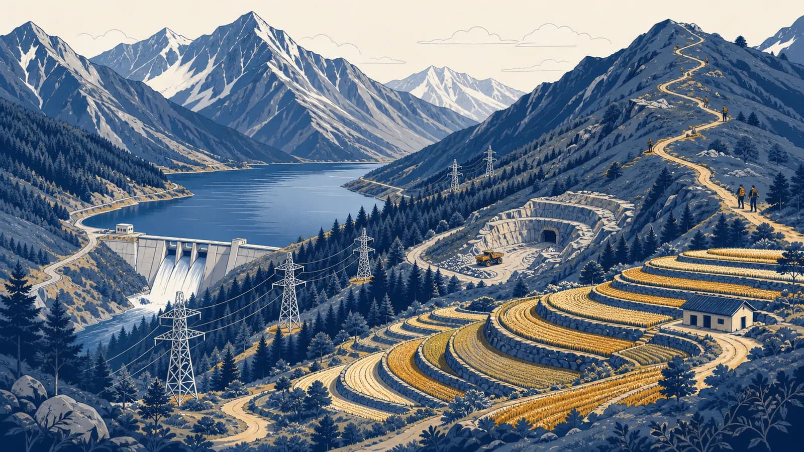
Mountains as resources is a geographical concept that explains how people obtain useful materials, energy, water, food, space, and income from high relief landscapes, in the context of physical and human geography. Mountain resources include freshwater, hydropower, minerals, forests, grazing land, farm terraces, tourism sites, and transport corridors. The idea exists because altitude, steep slopes, rock structure, climate, and remoteness concentrate some opportunities while limiting access to them. A resource is therefore not simply something present in a mountain. It is something people can identify, reach, use, and manage without destroying the system that produces it.
What mountains as resources actually means
Mountains become resources when people assign value to their physical features and develop the knowledge, rights, labour, and infrastructure needed to use them. The same river, slope, forest, or rock body may be valuable to one group and unusable or sacred to another.
A mountain is a landform with substantial height and local relief, but height alone does not explain its resource value. Relief controls slope, drainage, erosion, transport, and settlement. Altitude changes temperature and often changes precipitation. Exposed rock reveals geological materials. Differences over short horizontal distances create several environments close together, so a single mountain valley may contain orchards, conifer forest, summer pasture, reservoirs, and snowfields.
Geographers separate a stock from a resource. Copper ore underground is a stock of material. It becomes an economic resource only if its concentration can be measured, extraction is technically possible, someone has a legal right to mine it, and the expected value can cover the financial and environmental costs. A waterfall is a physical feature. It becomes a hydropower resource when water flow, vertical drop, turbines, transmission lines, permits, and electricity demand are connected.
Snow accumulates at high elevation, timber grows on a slope, or metal-bearing rock lies underground. This describes physical availability.
People can reach it, have permission to use it, possess suitable technology, and accept the costs and risks. This describes practical availability.
This distinction prevents a common error: treating every mapped deposit or river as immediately available wealth. Geography asks who can use a resource, by which route, at what season, under which law, and with what effects elsewhere. Those questions connect landforms to economies and politics. They also show how physical and human systems fit into geography.
How mountain water supply works
Mountain water supply works by storing precipitation as snow, ice, soil moisture, groundwater, lakes, and reservoirs, then releasing it downhill through streams and rivers. The timing of storage and melt can be as important as the total amount of precipitation.
Air forced up a mountain slope expands and cools. If it cools enough, water vapour condenses into cloud and may fall as rain or snow. This process, called orographic uplift, can make a windward slope wetter than nearby lowlands. Air descending the other side warms and dries, creating a rain shadow. The pattern is not automatic because wind direction, latitude, season, and mountain shape all matter, but uplift explains why headwaters often form in high country.
Snowpack delays runoff. Winter precipitation remains frozen, then melting supplies rivers in warmer months. Glaciers also store water across years, but they are not an unlimited tank. A shrinking glacier can initially add more meltwater to a river. After the ice mass becomes smaller, summer flow can fall because less stored ice remains. Reservoirs change timing again by holding wet-season flow for irrigation, drinking water, flood management, or electricity generation.
Water flow is not the same as water supply. A river becomes a dependable supply only when its seasonal timing, quality, legal allocation, storage, and delivery system match human and ecological demand.
Land cover affects both quantity and quality. Roots open pathways into soil, while leaf litter slows surface runoff. This can reduce erosion and help water enter the ground. A burned, logged, grazed, or paved slope may shed water faster, carrying sediment into a reservoir. Yet forests also use water through transpiration, so planting trees does not guarantee more river flow. The result depends on species, soil, climate, and the previous land cover.
Mountain water creates an upstream and downstream relationship. A decision to divert a headwater stream may benefit a power station or hillside farm but reduce flow for a town farther down. Sediment trapped behind a dam may protect one channel while depriving downstream floodplains of material. Resource management therefore follows the entire drainage basin, not just the point where water is captured.
How steep relief creates energy resources
Steep relief creates energy resources because water at a higher elevation has gravitational potential energy, strong winds can cross ridges, and sunny slopes may suit solar generation. Each opportunity depends on site conditions and on a connection to energy users.
Hydroelectric power turns falling water into rotation. Water enters an intake, moves through a pipe or tunnel called a penstock, spins a turbine, and drives a generator. Engineers care about head, the vertical distance through which water falls, and flow rate, the volume passing each second. Greater head or greater flow can produce more power.
For water density , gravity , flow , head , and efficiency , output is , about 785 kW.
The worked result is a rate, not a promise of constant output. River flow changes through the year, ice can obstruct equipment, sediment wears turbine parts, and drought reduces generation. A storage dam can regulate flow but floods land and blocks movement of sediment and aquatic life. A run-of-river plant usually stores less water, although its roads, pipes, and diverted channels still alter a valley.
Ridges may expose turbines to strong wind, and high sites may have clear solar exposure. They are also hard places to build. Equipment must travel on steep roads, foundations must withstand unstable ground, and transmission cables must cross long distances. Evaluating how energy resources affect political power adds another layer: electricity generated in one mountain district may serve distant industries while local communities bear changes to land and rivers.
How rocks, soils, forests, and grasslands become resources
Mountain materials become resources through different biological and geological processes: uplift and erosion expose rock, weathering forms soil, climate supports forests, and seasonal plant growth feeds grazing animals. Extraction rates must be matched to renewal rates where renewal is possible.
Geology concentrates minerals and building stone
Mountain building folds, faults, heats, and fractures rock. Magma and hot fluids can move metals into cracks, where they cool and form mineral deposits. Later uplift and erosion expose some deposits near the surface. Quarries may provide limestone, slate, granite, sand, or gravel. Mines may target metal-bearing ores, but the useful material is commonly mixed with much larger volumes of waste rock.
Mining requires more than digging. Exploration maps the deposit. Engineers plan tunnels or an open pit. Ore is crushed and processed to separate valuable minerals. Waste rock and fine tailings need stable storage, often on steep land where failure could send polluted material into a river. Water entering a mine can react with sulphide minerals and produce acidic drainage. Treatment may therefore continue after profitable extraction ends.
Soil and aspect control farming
Mountain soils are often thin because gravity and runoff remove weathered material. Farmers build terraces to shorten and flatten slopes, slow water, and retain soil. Terrace walls still require drainage and maintenance. If water saturates the soil behind a wall, pressure rises and failure becomes more likely.
Aspect is the direction a slope faces. In the Northern Hemisphere, a south-facing slope usually receives more direct sunlight than a north-facing slope at the same latitude and elevation. In the Southern Hemisphere, the general pattern reverses. Aspect changes warmth, evaporation, snow persistence, crop choice, and the location of houses or vineyards.
Forests and pastures renew only under limits
Mountain forests provide timber, fuelwood, fibre, foods, and habitat. They can also hold soil and intercept falling rain. Trees are renewable only if harvesting stays within the forest's capacity to regrow and if soil, water, and species diversity remain functional. Cutting a slow-growing high-altitude forest at the rate used in a warmer lowland forest can turn a renewable stock into a long shortage.
Seasonal grazing uses elevation zones. Herders can move animals uphill as snow melts and plants emerge, then return to lower ground before winter. This movement spreads grazing pressure and uses vegetation that cannot easily be cropped. Too many animals, too long in one place, remove protective cover and compact soil. The resource is the continuing production of grass, not the one-time removal of every edible plant.
Mountain resources versus mountain ecosystem services
Mountain resources are goods or opportunities people use directly, while mountain ecosystem services are benefits produced by functioning ecological processes. The categories overlap, but the distinction exposes benefits that markets often ignore, such as habitat, erosion control, and water purification.
| Mountain feature | Direct resource use | Ecosystem service | Possible tension |
|---|---|---|---|
| Forest | Timber and fuelwood | Habitat and slope protection | Fast cutting can reduce cover and fragment habitat |
| River | Irrigation and hydropower | Aquatic habitat and sediment transport | Diversion changes flow and dams trap sediment |
| Grassland | Livestock forage | Soil cover and carbon storage | Heavy grazing can expose and compact soil |
| Scenic ridge | Tourism income and wind energy | Cultural meaning and wildlife movement | Construction can alter views and movement routes |
Calling a forest a resource can focus attention on wood that can be sold. Calling it part of a watershed focuses attention on infiltration, sediment, shade, and river temperature. Neither description is complete by itself. A sound geographical account tracks material flows and also asks who gains from each benefit.
A town considers clearing a forested slope for a quarry. Stone sales and jobs appear in the project budget. The analysis must also count haul-road traffic, dust, lost habitat, altered runoff, waste storage, and the cost of stabilising the site after closure. Some effects occur downstream or years later.
Values can conflict even when no market price exists. A peak may be a climbing destination, a water source, wildlife habitat, and a place of spiritual importance at the same time. Labelling one use as development and the others as obstacles hides the real choice. Mapping overlapping claims makes the decision visible.
How mountain resources show up in jobs and infrastructure
Mountain resources appear in work through farming, forestry, mining, water management, energy, transport, conservation, and tourism. Most of these jobs depend on infrastructure that moves people, products, electricity, information, or water across difficult terrain.
A hydrologist measures rainfall, snow, stream flow, and water quality. A geologist maps rock and faults. A civil engineer designs retaining walls, tunnels, dams, and roads. Farmers manage terraces and irrigation. Foresters plan harvests and regeneration. Rangers protect habitats and guide visitors. Rescue teams interpret weather and avalanche conditions. Local government staff handle land rights, permits, emergency planning, and competing demands.
Infrastructure changes what counts as accessible. A tunnel can replace a high pass closed by snow. A cable car can bring visitors to a ridge. A transmission line can turn a remote river into an electricity source for a city. Mobile communications can support emergency warnings and bookings. Each connection also changes land use by lowering travel time and inviting more traffic or construction.
Mountain roads reveal the interaction clearly. A route must limit its gradient, cross rivers, avoid unstable slopes, and survive freeze-thaw weathering. Hairpin bends reduce gradient by increasing distance. Cut slopes expose rock, while embankments load the ground below. Drainage channels keep water from weakening the road base. Maintenance is part of the resource system because an unusable road isolates products from markets.
A pass can funnel movement through one narrow corridor. This helps explain how mountain passes shape trade routes, border crossings, service towns, and strategic control. A route may carry farm goods, minerals, tourists, or fuel, but one landslide can interrupt all of them. Redundant routes and local storage reduce that vulnerability.
How access turns mountain wealth into trade and conflict
Access turns mountain wealth into trade when roads, rights, technology, capital, and markets connect a resource to users. The same connections can create conflict if benefits leave the region, costs stay local, or several groups claim the same land and water.
Resource decisions involve a chain of control. Someone owns or governs the land. Someone issues permission. Workers extract or maintain the resource. A company or public agency moves it. Consumers may live far away. Tax income, wages, profit, electricity, and environmental damage can follow different paths. A mine can produce export revenue while a nearby settlement experiences dust and heavier traffic. A dam can supply a distant city while changing fisheries in the source valley.
Locate water, forest, grazing land, ore, scenery, and transport corridors. Record seasonal change and natural hazards.
Find legal owners, customary users, Indigenous claims, public agencies, downstream communities, and ecosystems affected by use.
Follow products, water, power, wages, taxes, pollution, risk, and displacement rather than counting output alone.
Compare locations, scales, seasons, technologies, demand reduction, restoration plans, and the option of leaving the stock in place.
Conflict is not proof that a resource has no value. It often means several values occupy the same space. A river can serve irrigation, hydropower, drinking water, habitat, recreation, and cultural practice. Allocating all dry-season flow to one use excludes others. The geography of why natural resources produce conflict follows these overlapping claims, unequal bargaining power, and uneven exposure to harm.
Good agreements specify more than a total amount. Water rules may define minimum ecological flow, withdrawal points, drought restrictions, and monitoring. A mining permit may require tailings standards, financial security for closure, and water treatment. A tourism plan may cap vehicle access or direct fees toward trail repair. Enforcement matters because a rule without measurement cannot reliably change behaviour.
Four mistakes people make with mountain resources
Four recurring mistakes distort mountain resource decisions: treating presence as availability, assuming renewable means unlimited, ignoring downstream effects, and measuring only market output. Correcting them requires attention to access, renewal rates, connected systems, and distribution.
1. A mapped stock is treated as available supply
A map may show a glacier, forest, mineral deposit, or windy ridge. It does not show that use is affordable, lawful, safe, or socially accepted. Distance, slope, weather, ownership, processing, waste, and transmission can prevent extraction. A resource estimate should state its conditions, not present a coloured area as guaranteed supply.
2. Renewable is mistaken for unlimited
Forests and pastures can regrow, and rivers are replenished by the water cycle. Renewal takes time and varies by season. Harvesting trees faster than regrowth reduces the stock. Taking nearly all low-flow water can damage a river even if rain returns later. Sustainable use stays within the system's rate and pattern of recovery.
3. The project boundary is mistaken for the system boundary
A dam wall, quarry fence, or ski area has a visible edge. Water, sediment, wildlife, traffic, smoke, and employment cross that edge. A narrow assessment misses displaced effects. The correct study area follows the process: the drainage basin for river changes, the migration route for wildlife, or the road network for freight.
4. High output is mistaken for broad benefit
Tonnes of ore, units of electricity, timber volume, and visitor numbers measure production. They do not show who receives income, who loses access, or who pays for clean-up. Distribution matters. A smaller project with local employment and enforceable restoration may create a different result from a larger project whose profit leaves the region.
This sentence is a summary, not a historical quotation. It captures why resource maps must be read alongside settlement maps, transport networks, legal boundaries, hazard zones, and evidence of ecological change.
How climate change alters mountain resources
Climate change alters mountain resources by shifting snow and rain, thawing frozen ground, changing ecosystems, and modifying hazards. The result is not one uniform loss: timing, location, exposure, and the ability to adapt determine which uses become less reliable.
Warmer conditions can raise the elevation at which precipitation falls as snow. Less snow storage may move runoff toward winter and early spring, leaving less meltwater during a warm, dry season. Glacier retreat can change flow over decades. Thawing permafrost can weaken rock faces and foundations. Species may move uphill when temperature zones shift, but those already near summits have little higher habitat available.
Hazards can combine. Intense rain on a steep, burned, or thawing slope can mobilise loose sediment. A landslide can block a river and form a temporary lake. If the natural dam fails, water and debris can move downstream quickly. Risk managers use monitoring, land-use controls, drainage, protective structures, evacuation routes, and warnings. No single measure removes all risk.
Adaptation changes resource use. Water managers can alter reservoir rules, repair leaks, change crop timing, or protect headwater vegetation. Tourism businesses can reduce dependence on snow by offering activities in other seasons, although more visitors can add pressure to water, housing, and trails. Adaptation should not transfer risk silently to a downstream community or future taxpayer.
How local livelihoods use and govern mountain environments
Local livelihoods use mountain environments by matching farming and tourism to altitude, season, access, and environmental limits. Their success also depends on governance: the property rights, customary practices, public laws, and community decisions that determine who may use each resource.
How mountain farming works on limited flat land
Mountain farming works by matching crops and animals to elevation, aspect, soil depth, water, and season, then reshaping some slopes with terraces or irrigation. It produces food in difficult terrain but remains sensitive to erosion, labour shortages, and road access.
Elevation creates vertical zones. A crop that needs warmth may grow on a lower sunny slope, while higher grassland supports summer grazing. Terraces create level planting surfaces and reduce the speed of overland flow. Channels distribute water across slopes, but poorly controlled irrigation can saturate soil or erode terrace edges. Farmers often spread risk through several plots, crops, or elevation bands.
Access determines what can be sold. A durable crop may tolerate a slow trip down a rough road, while fresh milk or soft fruit needs quick transport and cooling. A road closure can turn a productive field into a temporary food supply for the household rather than a market resource. Mountain farming therefore connects directly to storage, processing, transport, prices, and the reliability of supply.
Read a terrace as a system. Its wall holds soil, its surface controls slope, its channel moves water, its crop generates value, and continued maintenance keeps all four functions working.
How tourism uses mountain environments
Mountain tourism turns scenery, snow, wildlife, culture, trails, and physical challenge into services that visitors buy. Its resource is an experience, so income depends on environmental quality, safe access, skilled work, accommodation, and limits that prevent overuse.
Tourism can diversify income where farming or extraction is constrained. Guides, drivers, cooks, instructors, equipment technicians, builders, and accommodation workers all take part. Visitor spending may support conservation or trail maintenance when fees are directed that way. It can also raise land values, strain water systems, produce waste, disturb wildlife, and create seasonal employment.
Capacity is not simply the number of beds. A valley's practical limit may be set by road congestion, wastewater treatment, rescue coverage, trail erosion, wildlife disturbance, or residents' access to housing. Different limits apply in different seasons. Counting arrivals without measuring these pressures can make growth look beneficial after service quality and local living conditions have begun to decline.
Who decides how a mountain resource is used
Mountain resource use is decided through a mixture of property rights, customary practice, Indigenous authority, public law, permits, contracts, and community power. A legitimate decision identifies affected groups early and gives them usable information and a meaningful way to influence outcomes.
Ownership does not always include every right. One party may own the surface, another may hold mineral rights, the public may have access rights, and a government may regulate water or protected species. Customary grazing or sacred use can predate formal title. A clear map of rights helps, but negotiation is still needed where claims overlap.
Time also changes the answer. A project may produce income for twenty years while waste storage needs oversight for much longer. A forest harvest today affects later harvests. A reservoir built for a past climate may no longer match the timing of runoff. Decisions should include monitoring points and conditions for revision, not assume the first plan remains suitable forever.
The takeaway: Evaluate a mountain resource by tracing the physical process that creates it, the connections that make it usable, the people who control and benefit from it, and the ecological limits that allow it to continue.
Mountains reveal how geography connects nature and choice
Mountains reveal a central geographical fact: natural features create possibilities, but human decisions determine which possibilities become resources and how their gains and costs are distributed. Relief, climate, ecology, infrastructure, law, and power must be read together.
When you next see a mountain road, reservoir, terrace, forest edge, power line, quarry, or trail, follow its connections. Ask what physical process supports it, what enters and leaves, who maintains it, who benefits, and what could interrupt it. Then widen the map. Look uphill for the source, downhill for the effects, and outward for the market or institution that makes the use possible.
That habit turns a scenic landform into evidence. Mountains are water towers, barriers, corridors, workplaces, habitats, and homes because several systems occupy the same slopes. Geography makes those systems visible enough to compare choices, test claims, and notice when one use is being counted while another is being erased.