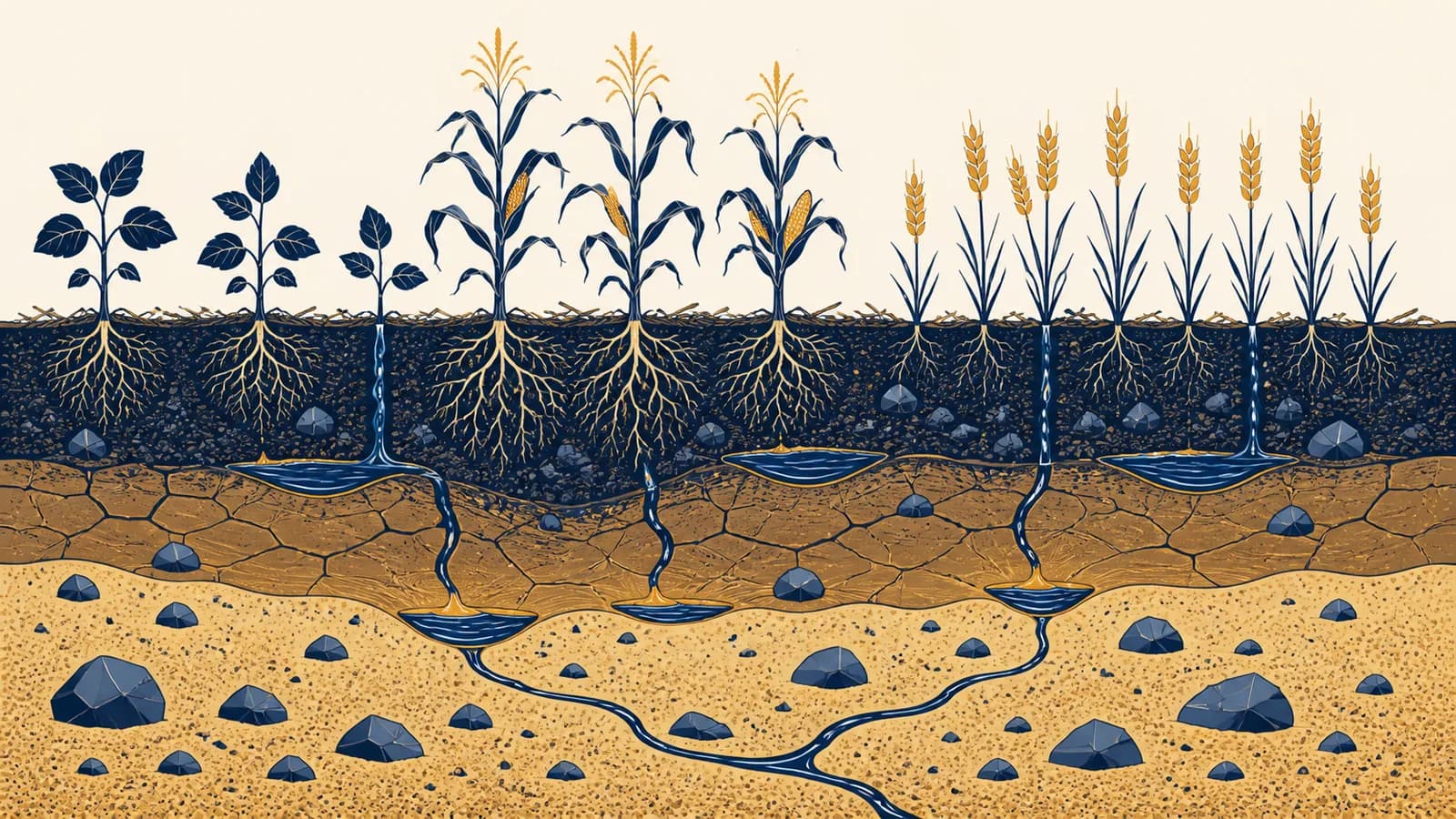
Soil type is a classification that groups ground by its physical and chemical properties, in the context of geography and agriculture. Soil types help explain why crops grow well in one field but struggle in another. The main agricultural soil types are sandy, silty, clayey, and loamy soils, although real soils also differ in structure, depth, organic matter, drainage, acidity, and salt content. Soil classification exists because farmers, engineers, and land managers need a shared way to predict how soil will hold water, supply nutrients, support roots, and respond to cultivation.
A handful of soil rubbed between wet fingers can already reveal useful information. Grit suggests sand. A smooth, floury feel points toward silt. A sticky sample that can be shaped into a ribbon contains substantial clay. These differences come from particle size, but particle size starts a chain of effects involving pores, water, oxygen, microbes, roots, and farm machinery.
What soil actually is
Soil is a living, porous mixture of mineral particles, organic matter, water, air, and organisms that develops at Earth’s surface. It is more than broken rock because its layers and biological activity can store nutrients, filter water, and support rooted plants.
The mineral part usually begins with weathered rock or with loose material carried in by rivers, glaciers, wind, or gravity. Organic matter enters as dead roots, leaves, manure, and organisms decompose. Water occupies some pores, air occupies others, and bacteria, fungi, earthworms, insects, and plant roots continually alter the mixture.
Those diameter boundaries define soil texture. Sand particles range from 0.05 to 2 millimetres under the United States Department of Agriculture scale, silt particles range from 0.002 to 0.05 millimetres, and clay particles are smaller than 0.002 millimetres. Other classification systems use slightly different boundaries, so a report should state which system it follows.
Texture names describe proportions, not purity. A sandy loam contains enough sand to behave mainly like a coarse soil, plus enough silt and clay to change its water and nutrient behaviour. Loam is a family of balanced mixtures, not a recipe containing equal thirds of sand, silt, and clay.
Soil is both material and system. Its particles set physical limits, while roots, organisms, water, weather, and management keep changing what happens inside those limits.
How soil forms and develops
Soil forms as climate, organisms, relief, parent material, and time act together on a site. Weathering produces mineral particles, life adds and mixes organic material, moving water relocates substances, and landscape position controls erosion, drainage, and accumulation.
Parent material supplies the starting minerals. Granite can weather into material rich in quartz and feldspar. Limestone can produce calcium rich soils, although rainfall and drainage may later remove much of that calcium. River alluvium can bring a mixed, renewed sediment rather than a soil derived from the bedrock directly below.
Climate controls the speed and direction of many reactions. Warm, wet conditions generally speed chemical weathering and decomposition. Strong rainfall can carry dissolved bases and fine particles downward. In dry settings, evaporation may pull water upward and leave salts behind. Freezing, heating, cooling, and wetting also break material physically.
Organisms supply carbon and move material. Roots open channels, release compounds, take up ions, and leave residues. Soil animals mix particles. Microbes turn organic remains into simpler compounds and stable organic matter. Vegetation also protects the surface from raindrop impact and slows runoff.
Relief means slope, elevation, and position in the terrain. A steep upper slope often loses soil by erosion and drains quickly. A lower hollow can receive sediment and remain wet. Two points separated by a short walk can therefore have different soil depths even under the same rainfall and rock type.
Time allows horizons to become clearer, but older does not automatically mean more fertile. Long weathering can release nutrients, then prolonged leaching can remove them. Floods, landslides, ploughing, deposition, and erosion can reset part of the profile.
How soil texture controls water and air
Soil texture controls water and air by determining the size and arrangement of pore spaces between particles. Coarse sandy soil drains rapidly and holds less plant available water, while fine textured soil stores more water but may drain and aerate slowly.
Large sand grains tend to create large pores. Gravity empties many of these pores after rain, allowing air to return quickly. This helps roots breathe but means that water and dissolved nutrients can pass below the root zone. Sandy ground often warms quickly and is easy to cultivate, yet it may need smaller, more frequent applications of irrigation and fertilizer.
Clay has an enormous surface area relative to its mass because its particles are so small. Water and nutrient ions can cling to those surfaces. Fine pores also hold water strongly. Some of that water remains unavailable to plants because roots cannot pull hard enough to remove it. A clay soil can therefore contain plenty of total water while a crop still experiences water stress.
Silt falls between sand and clay in particle size. Silty soils can hold useful water and feel smooth, but bare silt is easily detached by rain and moved by runoff or wind. Loamy soils combine particle sizes, so they often balance drainage and storage well. Their behaviour still depends on structure, organic matter, depth, and compaction.
The total amount of water in a soil sample, including water held too tightly for roots to extract.
The portion roots can draw from soil after free drainage but before the soil becomes too dry for the plant.
After saturated soil drains freely, it reaches a condition called field capacity. As plants withdraw water, the remaining water becomes harder to extract. The permanent wilting point marks a standard lower limit at which a plant cannot recover its firmness in that soil under defined conditions.
If field capacity is 0.30, wilting point is 0.15, and root depth is 600 mm, then available water is (0.30 minus 0.15) times 600, which equals 90 mm.
The formula treats the two water contents as volume fractions and multiplies their difference by soil depth. It is a simplified estimate. Stones, shallow rooting, hard layers, uneven wetting, and salt can reduce the amount a crop can actually use.
Soil texture versus soil structure
Soil texture is the proportion of sand, silt, and clay, while soil structure is the way those particles bind into aggregates. Texture changes little under normal farming, but roots, organic matter, traffic, tillage, and wetting can improve or damage structure.
A clay field does not behave as one solid block when it has good structure. Clay, silt, sand, organic compounds, fungal threads, and roots can form crumbs or larger aggregates. Pores between aggregates transmit air and water. Smaller pores within them store water. This arrangement lets a fine textured soil combine storage with drainage.
Compaction squeezes large pores, especially when heavy equipment crosses wet ground. The soil may keep the same percentages of sand, silt, and clay, yet infiltration slows, puddles remain, and roots turn sideways above the dense layer. This is a structural change, not a textural one.
A tractor enters one half of a clay loam field soon after heavy rain and leaves the other half untouched. Weeks later, the trafficked half shows standing water and shallow roots. A laboratory texture test gives the same result for both halves. The difference lies in pore arrangement and bulk density.
Organic inputs can support aggregation because decomposers produce binding substances and roots create channels. Cover crops also shield the surface and supply residues. These practices do not turn clay into loam, but they can make clay easier for water, air, and roots to enter.
How a soil profile records movement
A soil profile is a vertical section showing horizons created by additions, losses, transfers, and transformations of material. Its colours, boundaries, roots, pores, stones, and textures reveal how water moves, where organic matter collects, and what may restrict crops.
Many profiles have an organic surface layer, a dark mineral topsoil, a lighter or altered zone below, a subsoil where clay or iron may accumulate, and partly weathered parent material. Horizon letters such as O, A, E, B, C, and R provide a useful vocabulary, but not every soil contains every horizon.
Use a soil pit, road cutting, or auger samples to see vertical change without mixing the layers.
Look for changes in colour, texture, structure, stones, roots, and moisture rather than assuming fixed depths.
Push a knife or probe into the face, inspect root paths, and check whether water sits above a dense or slowly permeable layer.
Record slope position, vegetation, drainage, erosion, and land use because the profile only makes sense within its setting.
Colour is evidence, not a diagnosis by itself. Dark topsoil often contains more organic matter, but dark colour can also reflect wetness or parent material. Red and yellow colours commonly come from oxidized iron compounds. Grey colours and rusty mottles can indicate prolonged saturation and repeated changes between oxygen rich and oxygen poor conditions.
Depth matters because roots need both volume and access. A fertile surface over shallow bedrock stores less water than the same topsoil over a deep, permeable subsoil. A compacted plough pan, a cemented horizon, gravel, salt, acidity, or seasonal saturation can define the effective rooting depth long before bedrock appears.
Never enter an unsupported soil pit. Soil faces can collapse without warning. Field workers inspect deep profiles using properly supported excavations or safe exposed sections.
How soil chemistry controls plant nutrition
Soil chemistry controls which nutrients remain stored, dissolve in water, or become available to roots. Acidity, mineral surfaces, organic matter, salts, and microbial reactions interact, so adding fertilizer does not guarantee that a crop can absorb the element supplied.
Soil pH expresses acidity on a logarithmic scale. A fall of one pH unit means the hydrogen ion activity is ten times greater. Most crops grow within a middle range because extreme acidity or alkalinity can reduce nutrient availability, harm roots, or favour toxic concentrations. The best target depends on the crop and soil.
A solution changing from pH 6 to pH 5 has ten times the hydrogen ion activity, not one extra unit of acidity.
Clay particles and organic matter often carry electrical charges that hold positively charged nutrient ions such as calcium, magnesium, potassium, and ammonium. This storage ability is described by cation exchange capacity. A sandy soil with little organic matter commonly stores fewer of these ions, making careful timing especially important.
Nitrogen shows why chemistry and biology cannot be separated. Microbes convert organic nitrogen into ammonium, and other microbes can convert ammonium into nitrate. Nitrate dissolves readily and can move with drainage water. In saturated, oxygen poor soil, microbes may convert nitrate into gases that leave the soil. Conditions decide the pathway.
Salinity creates a different problem. Dissolved salts make it harder for roots to take up water, even when the ground looks moist. Sodium can also disperse clay and damage structure in susceptible soils. Irrigation therefore involves both quantity and quality, linking field soils to how rivers, aquifers, and irrigation supplies are managed.
A soil test is useful only when sampling represents the field. A mixed sample should combine many small cores taken to a consistent depth while avoiding unusual patches unless those patches are being tested separately. Laboratory results then guide amendments, but expected yield, crop demand, soil texture, weather, and previous management still affect the decision.
How soil type shows up in crop decisions
Soil type shapes crop choice, planting date, irrigation, nutrient timing, machinery use, and erosion control. Farmers do not select crops from texture alone; they combine profile depth, drainage, climate, slope, market needs, equipment, and past field performance.
On freely draining sandy soil, a farmer may plant earlier because the surface warms and dries sooner. The same field may need frequent irrigation because its water reserve is small. Splitting fertilizer into several doses can reduce the amount lost below the roots during heavy rain or irrigation.
A clay soil may store more water and nutrients, but cultivation at the wrong moisture content can create clods, smearing, and compaction. Waiting until it is dry enough protects structure. Drainage may be needed where a slowly permeable subsoil keeps the root zone saturated, although draining wetlands or organic soils can create serious ecological and carbon costs.
A grower has two 300 millimetre root zones. Soil A can supply 45 millimetres of plant available water, while Soil B can supply 75 millimetres. If the chosen management trigger is half the reserve, irrigation begins after roughly 22.5 millimetres has been used in Soil A and 37.5 millimetres in Soil B. Local weather and crop measurements still decide the actual timing.
The arithmetic explains why one fixed irrigation calendar performs poorly across different fields. Crop roots also change with growth stage, so the active reservoir becomes deeper as roots extend. Sensors, weather estimates, field inspection, and water accounts can refine the schedule.
Farmers manage variation within fields as well as differences between named soil types. A low clayey patch may stay wet while a sandy rise dries. Yield maps, electrical conductivity surveys, aerial images, soil cores, and direct observation help locate zones. Variable rate equipment can then change seed, lime, or fertilizer applications, but only if the mapped pattern has a sound soil explanation.
What the land can sustain, given soil limits, slope, erosion risk, wetness, and climate.
What happened under a particular season, crop, input level, price, and management system.
A high yield in one year does not erase a long term erosion risk. Likewise, a low yield can result from drought, pests, poor timing, or market driven input choices rather than an incapable soil. Agricultural geography joins the physical land with the human decisions made on it.
How erosion and degradation change agricultural soil
Soil degradation reduces the land’s ability to support plants or regulate water through erosion, compaction, salinization, contamination, acidification, or loss of organic matter. These processes often reinforce one another, turning a manageable limitation into a larger production and environmental problem.
Erosion begins when raindrops, flowing water, or wind detach and transport particles. Fine particles and organic matter are often valuable parts of topsoil, so their removal can reduce nutrient storage and water holding capacity. Deposited sediment may clog channels or cover crops elsewhere. Bare, smooth, sloping ground is especially exposed.
The erosion sequence can become a feedback loop. Topsoil loss reduces plant growth. Sparse cover leaves more ground exposed. Runoff then removes more soil. The same interaction between vegetation, water, and land use appears in how productive dryland loses vegetation and soil.
Protection interrupts that loop. Crop residue and cover crops absorb raindrop energy. Contour cultivation slows flow across slopes. Grassed waterways carry concentrated runoff without exposing bare soil. Terraces shorten a slope, and windbreaks reduce wind speed. The suitable combination depends on rainfall, soil, slope, field size, and machinery.
Compaction needs a different remedy. Preventing traffic on wet soil, reducing axle loads, using permanent traffic lanes, and maintaining living roots can preserve pores. Deep loosening may break a dense layer, but its benefit can disappear if heavy machinery compacts the ground again. Treatment must match the depth and cause of the problem.
Salinization often develops where irrigation water adds dissolved salts and insufficient drainage fails to carry them away. Evaporation removes water but leaves the salts. Applying extra water can leach salts only where drainage is adequate and the receiving water can be managed safely. The repair is a water balance problem as much as a soil problem.
Soil life also connects farms with surrounding habitats. Pollinators, decomposers, predators, roots, and water cross field boundaries, a relationship developed further in how climate, organisms, and soils shape ecosystems.
How do you identify a soil type?
A soil type is identified by combining field observations with measured particle size, horizons, chemistry, drainage, and site position. A hand texture test gives a quick estimate, while laboratory analysis and a formal classification system provide repeatable names and clearer comparisons.
Start with a representative sample, moisten it gradually, and remove large stones and roots. Rub it between the fingers. Sand feels gritty, silt feels smooth, and clay feels sticky and plastic. Press the sample into a ball, then squeeze it between thumb and forefinger to form a ribbon. A longer, stronger ribbon generally indicates more clay.
The jar settling demonstration can show that different particle sizes settle at different rates, but it is not automatically an accurate texture analysis. Organic matter can float, clay can remain clumped, particle shapes differ, and reading layer boundaries can be subjective. Professional laboratories use controlled preparation and standard methods.
Texture calculation: A 100 gram mineral sample containing 60 grams of sand, 25 grams of silt, and 15 grams of clay is 60 percent sand, 25 percent silt, and 15 percent clay. A standard texture triangle converts those three percentages into a texture class.
A map name may describe more than texture. Formal soil survey units can include profile properties, slope, erosion, wetness, stoniness, and expected variation. Ground checking remains necessary because map boundaries are estimates and small patches may be too narrow to show at the published scale.
Which soil type is best for agriculture?
No single soil type is best for every form of agriculture. Deep, well structured loam is versatile because it can balance water storage, drainage, aeration, and nutrient retention, but crop needs, climate, slope, salinity, drainage, and management determine actual suitability.
Carrots need a loose rooting zone to develop straight roots, while rice production can use land that holds water. Grapevines may produce successfully on soils that would limit shallow rooted annual crops. Pasture can protect a steep slope that would erode under repeated cultivation. A soil can be excellent for one land use and poor for another.
Economics changes the answer without changing the soil. Drainage, irrigation, lime, fertilizer, raised beds, greenhouses, or erosion controls can overcome some limits, but each has costs and environmental effects. A physically possible crop may not be a sensible choice where water is scarce or the market is distant.
This computed comparison shows why surface texture alone can mislead. If Field A has a dense layer at 300 millimetres but Field B permits roots through 540 millimetres, Field B gives roots 80 percent more depth within the same 600 millimetre profile: 540 divided by 300 equals 1.8. The extra volume can hold water and nutrients.
Can farmers change a soil type?
Farmers can change soil condition far more easily than soil texture. Organic inputs, drainage, lime, gypsum in suitable sodic soils, cover crops, and traffic control can alter structure or chemistry, but changing the sand, silt, and clay proportions of a field is rarely practical.
Mixing enough sand into clay to change its texture would require moving a vast mass of material through the whole rooting depth. Adding a small amount may create an uneven mixture without solving drainage. Raised beds or imported topsoil can be realistic at garden scale, but they demand care because purchased soil varies and abrupt layer boundaries can impede water.
Organic matter is powerful because it feeds organisms, supports aggregates, stores nutrients, and influences water behaviour. It is also continually decomposed. One application does not permanently transform a field, and results depend on climate, soil, material, and management. Maintaining inputs and protecting the surface matter more than chasing a universal target.
Mineral particle size distribution across an entire field and rooting depth.
Aggregation, compaction, acidity, nutrient supply, surface cover, drainage, salinity, and biological activity.
The practical question is usually not how to replace the soil type. It is how to work with its limits while preventing damage. That shift leads to measurable actions such as keeping machinery off wet ground, testing pH, covering soil between crops, and matching irrigation to storage capacity.
Four mistakes people make with soil types
Common mistakes treat soil as a fixed texture label, judge fertility by colour, assume more fertilizer always means more growth, or ignore variation below the surface. Each mistake fails because crop performance comes from interacting physical, chemical, biological, and geographic conditions.
1. Calling every balanced soil loam
Loam is a defined texture class based on percentages of sand, silt, and clay, not a compliment for any soil that grows plants well. A clay loam and sandy loam behave differently. Use the texture triangle or laboratory result before assigning the name.
2. Treating dark soil as automatically fertile
Dark colour often suggests organic matter, but fertility also depends on pH, nutrient forms, drainage, salinity, rooting depth, and management. Some naturally dark soils remain waterlogged. Some pale soils support crops after careful amendment and irrigation. Colour begins an investigation rather than ending it.
3. Adding nutrients before finding the limit
A crop with oxygen starved roots cannot use fertilizer normally. A pH problem may make a nutrient difficult to absorb, and a shallow compacted layer may restrict the root system. Diagnosis should examine plant symptoms, soil tests, profile conditions, weather, and field patterns before treatment.
4. Sampling only the easiest spot
Gateways, headlands, wet hollows, old manure piles, and field edges may not represent the main area. A useful sampling design separates distinct management zones and combines multiple cores within each zone. Recording locations makes later tests comparable.
Soil turns physical geography into daily decisions
Soil connects rock, climate, water, landforms, ecosystems, and human land use in one visible profile. Reading that profile lets people predict opportunities and limits, then choose farming practices that fit the place rather than treating every field as interchangeable.
This is physical geography at working scale. Rainfall enters pores, slopes redirect it, minerals react, organisms recycle matter, and people alter the result through cultivation and water use. Soil patterns therefore help explain crop regions, settlement choices, food supply risks, river sediment, and landscape change. The wider connections sit within the rest of the physical and human geography guides.
Next time exposed ground appears in a garden, field, riverbank, or building site, look past the surface colour. Notice the particle feel, aggregates, roots, pores, stones, moisture, slope position, and any boundary that redirects water. Those observations turn the name of a soil type into an explanation of how the land works.
The takeaway: Texture sets the starting conditions, but profile depth, structure, chemistry, water, organisms, terrain, and management decide what a soil can do.