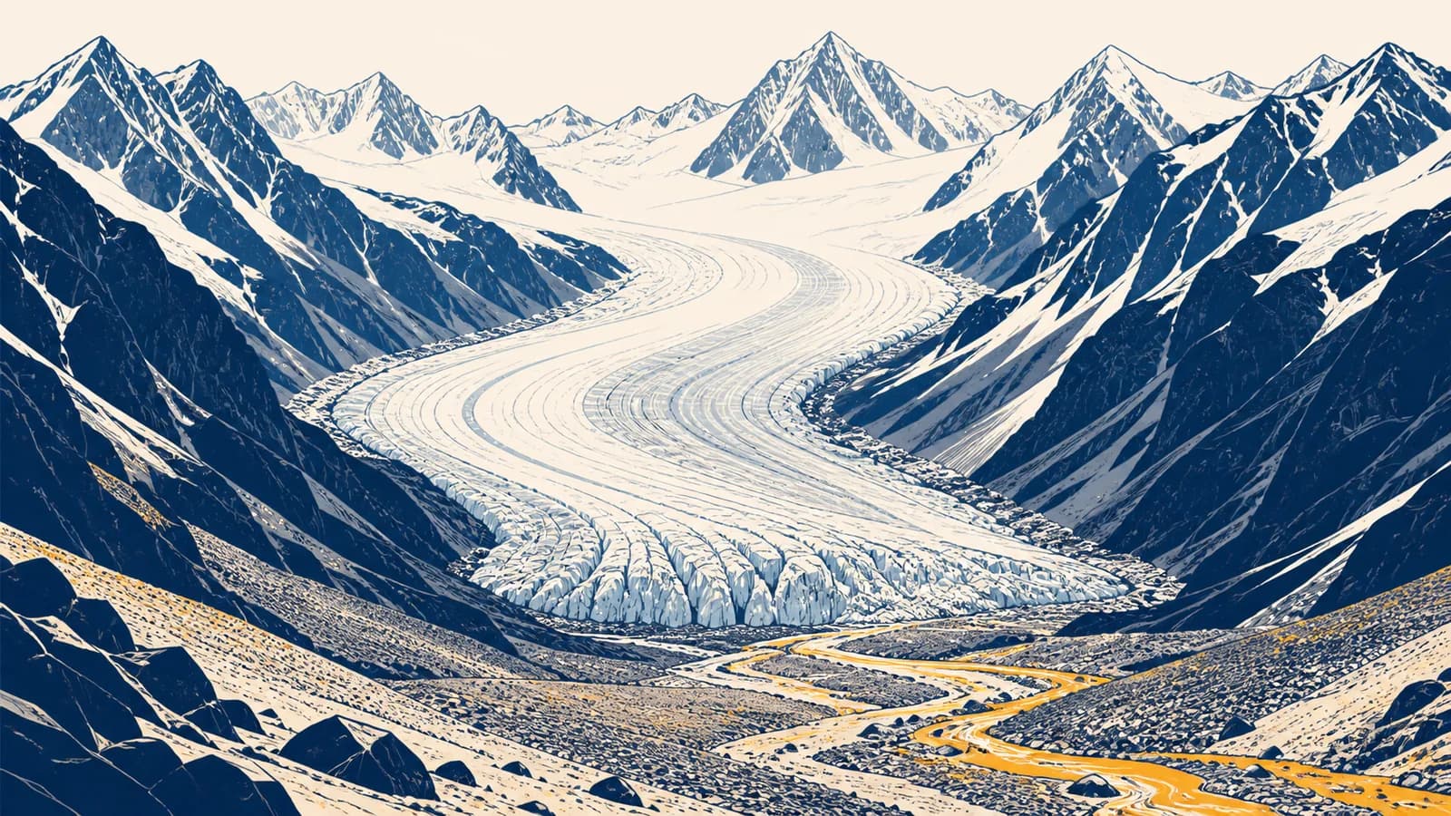
A glacier or ice cap is a body of land ice that stores fallen snow, flows under its own weight, and reshapes terrain in the physical geography of Earth’s cryosphere. A glacier forms where snow survives long enough to compact into ice; an ice cap is a dome of glacier ice that spreads outward across the land. People study glacier formation, movement, melting, erosion, and retreat because these processes store fresh water, alter sea level, expose climate change, and affect communities below mountains and beside coasts.
The ice can look fixed in a photograph, yet every active glacier is a moving system. Snow enters near the upper surface, ice travels through the body, and water, vapour, or icebergs leave elsewhere. Geography connects that physical system to valleys, rivers, settlements, hazards, and decisions about water and land.
What a glacier and an ice cap actually are
A glacier is a lasting mass of ice formed from snow on land that moves under gravity. An ice cap is a glacier with a dome-like surface, usually covering high ground, whose ice flows outward in several directions rather than down one valley.
The words lasting, formed on land, and moves separate glaciers from nearby kinds of ice. A winter snowfield may disappear in summer and never become a glacier. A frozen lake forms when liquid water freezes in place. Sea ice forms when ocean water freezes. Glacier ice begins as snowfall and becomes thick enough to deform or slide.
Glaciers take several forms. A valley glacier is channelled between mountain walls. A cirque glacier occupies a bowl near the head of a valley. An outlet glacier drains ice from a larger ice cap or ice sheet. A tidewater glacier reaches the sea and can release icebergs by calving. The category describes the setting and flow, not a different material.
Movement is part of the definition. A large patch of old snow is not automatically a glacier. Glacier ice deforms and transfers mass downslope or outward, even when that motion is too slow to notice during a visit.
An ice cap has no single valley controlling its overall shape. Its high central surface creates pressure that drives ice toward its margins. An ice field is also a broad mountain ice mass, but surrounding peaks and valleys strongly guide its flow. The much larger ice sheets of Greenland and Antarctica exceed 50,000 square kilometres, the size threshold used by NASA and glaciological reference works.
How snow becomes glacier ice
Glacier ice forms when repeated snowfall survives summer melt, becomes buried, and is compressed. Snow crystals round off and pack together as air spaces shrink, producing granular firn and then dense glacier ice over many seasons.
A glacier needs persistent accumulation. Wind and avalanches may add snow as well as direct snowfall, while sun, warm air, rain, and wind remove it.
Burial breaks delicate snowflakes and presses the grains into rounded particles. Meltwater may enter the spaces and refreeze. The result is firn, old compacted snow that has survived at least one melt season.
More layers increase the pressure. Grains recrystallise, air passages become isolated bubbles, and the material becomes glacier ice.
Once enough ice accumulates on a slope or dome, gravity creates stress within it. The ice changes shape internally and may also slide over its bed.
This transformation is not simply snow freezing. Fresh snow already consists of ice crystals, but much of its volume is air. Firnification rearranges crystals and squeezes the connected air spaces closed. Deep glacier ice therefore has far less empty space than recent snow.
Climate and location control how quickly the stages occur. Heavy snowfall can bury layers rapidly. Summer meltwater can speed densification when it percolates downward and refreezes. In very cold, dry interiors, little snow falls and the conversion may take much longer. The mechanism is the same, but the rate is not universal.
The sequence also explains visible bands in an ice cliff or core. Each layer can preserve dust, bubbles, refrozen meltwater, or volcanic ash from the time when the layer lay near the surface. Scientists use those features as evidence, but they must account for flow because ice layers can thin, tilt, and fold after burial.
How glacier movement works
Glaciers move because gravity creates stress in thick ice. The ice deforms through internal creep, while some glaciers also slide over rock or deform wet sediment at their beds. Speed varies across the glacier, with friction slowing its edges and base.
Internal deformation changes the shape of ice
Glacier ice is solid, but under sustained stress its crystals can change shape and shift past one another. Pressure from the ice above and the pull of gravity maintain that stress. This process, called creep, transfers ice downslope without requiring the whole glacier to detach from its bed.
Thickness matters because a thicker column places more weight above the bed. Slope matters because a steeper surface directs more of the gravitational force downslope. Ice temperature matters too. Ice near its melting point generally deforms more readily than very cold ice.
Basal motion lets the glacier move over its bed
Water at the base can reduce friction and allow ice to slide. The bed may also contain waterlogged sediment that shears and carries the overlying ice. Meltwater pressure changes over a day or season, so glacier speed can change even before the glacier becomes visibly larger or smaller.
Crevasses show that the upper ice is relatively brittle. Where flow accelerates, bends, or spreads, the surface is pulled apart and cracks open. Deeper ice is confined by pressure and tends to deform rather than stay as an open fracture. A crevasse field therefore maps stress in the moving surface, not a place where the entire glacier has split to its bed.
A hard, motionless block sits in a valley and melts at its lower end.
Ice continually enters from higher accumulation areas, deforms or slides through the glacier, and reaches lower ablation areas where mass is removed.
A glacier can flow forward while its terminus retreats. Imagine a moving walkway whose front edge is being cut away. If the walkway carries material forward at 20 metres per year but melting removes 30 metres of length at the front, the terminus shifts 10 metres uphill even though every parcel of ice still moves downhill. Retreat describes the position of the end, not the direction of ice flow.
How glacier mass balance works
Glacier mass balance is the change in stored snow and ice over a stated period. Accumulation adds mass, while ablation removes it through melting, runoff, sublimation, wind erosion, and calving. The difference determines whether the glacier gains or loses mass.
The upper part of many mountain glaciers is the accumulation zone, where the year leaves a net gain of snow. The lower part is the ablation zone, where the year leaves a net loss. Near the boundary lies the equilibrium line, the elevation at which annual accumulation and ablation are approximately equal. Its position changes with snowfall and melt conditions.
If accumulation is 1.6 metres water equivalent and ablation is 2.1 metres water equivalent, then metres water equivalent.
Scientists often report mass balance in metres of water equivalent. This converts snow, firn, and ice of different densities into the depth of liquid water they contain, making gains and losses comparable. A negative value means loss from the glacier system. It does not mean that every location on the surface lost the same thickness.
Consider a simplified glacier divided into three equal areas. The high zone gains 1.2 metres water equivalent, the middle zone loses 0.3 metres, and the low zone loses 1.5 metres. Because the areas are equal, their mean balance is metres water equivalent. Snow remained high on the glacier, but the glacier as a whole lost mass.
One snowy winter does not guarantee a positive year. A hot summer can remove the new snow and expose darker old ice, which absorbs more solar energy than clean snow. Likewise, a cool summer may preserve mass after an ordinary winter. Glaciers integrate both precipitation and energy conditions, which is why their changes are evidence of climate rather than simple thermometers.
Glaciers versus ice caps, ice sheets, and sea ice
These terms describe different bodies of ice. A glacier is flowing land ice; an ice cap is a dome-shaped glacier flowing outward; an ice sheet is a continental-scale mass; sea ice is frozen ocean water and is not a glacier.
| Ice type | Where it forms | What controls its movement or shape | Direct effect when it melts |
|---|---|---|---|
| Valley glacier | Snowy mountain basin | Valley walls channel flow downslope | Runoff enters rivers, lakes, or the ocean |
| Ice cap | Land, often on a plateau or island | A central dome sends ice outward in several directions | Runoff adds water to drainage basins and, eventually, often the ocean |
| Ice sheet | Greenland or Antarctica | Its enormous ice surface and bed topography direct broad flow and outlet glaciers | Lost land ice adds water to the ocean |
| Sea ice | Ocean surface | Winds, currents, temperature, and coastlines move and shape it | Melting changes ocean conditions but adds almost no new water volume because it already floats |
An iceberg is another commonly confused object. It is a piece of land ice that has calved into water and now floats. Its origin is glacial even though its present setting is marine. An ice shelf is a floating extension of land ice still attached to an ice sheet or glacier. Losing an ice shelf has little direct sea-level effect, but it can remove resistance that had slowed land ice behind it.
The distinction between land ice and floating ice connects directly to how oceans and coasts respond to changing water levels. It also prevents a familiar error: treating every photograph of polar ice loss as evidence of the same process.
How moving ice shapes the land
Glaciers reshape land by eroding rock, carrying debris, and depositing sediment. Abrasion grinds the bed, plucking removes blocks, flowing ice transports the load, and melting releases it. Repeated glaciation creates distinctive valleys, ridges, basins, and deposits.
Abrasion scratches and smooths bedrock
Rock fragments frozen into basal ice act like tools dragged across the bed. Fine particles polish the surface, while larger fragments cut grooves called striations. The direction of these marks can reveal past ice flow, although a geographer checks several features because later ice movement can cross older scratches.
Plucking removes jointed blocks
Water enters cracks in bedrock, freezes or refreezes, and helps loosen pieces. Ice flowing around a projection can grip fractured rock and pull blocks away. Abrasion and plucking often work together, producing a smoother upstream face and a rougher downstream face on a rock obstacle.
Deposition builds landforms from unsorted and sorted sediment
Till is sediment deposited directly by glacier ice, so it may mix clay, sand, gravel, and boulders without the size sorting typical of a river. Moraines are ridges or blankets of this debris at glacier sides, centres, beds, or former margins. Meltwater streams rework some debris and sort it by the speed of flowing water.
A river usually cuts a narrow V-shaped valley because most erosion is concentrated near its channel. A valley glacier fills much of a valley and erodes its floor and sides, producing a wider U-shaped cross-section. Tributary glaciers may cut less deeply than a main glacier, leaving hanging valleys after the ice retreats. Waterfalls often descend from those raised valley mouths.
You stand in a broad mountain valley with steep walls, scratched bedrock, a ridge of mixed boulders and clay, and a small lake behind that ridge. Together, the U-shaped profile, striations, unsorted till, and moraine-dammed lake support a glacial explanation more strongly than any single clue.
Glacial landforms influence later human use. Broad valley floors can carry roads and farms, but loose moraine material may be unstable. Basins become lakes or wetlands. Sand and gravel deposited by meltwater can supply construction material and store groundwater. The physical process continues to shape choices long after the ice is gone.
How glaciers show up in water supplies and hazards
Glaciers store winter precipitation and release meltwater during warmer periods, changing river timing and temperature. The same storage system can create floods, unstable lakes, falling ice, and debris flows, so communities monitor both the useful water and the hazards.
In a glacier-fed catchment, snowfall can remain locked in ice beyond the season or year when it fell. Summer energy then melts some of that store. This can support river flow during dry months, but the effect depends on glacier size, snowfall, temperature, basin area, and competing water demand. A glacier is not an unlimited reservoir.
As a glacier loses mass, extra melting can temporarily increase runoff. Continued shrinkage eventually leaves less ice available to melt, so late-summer flow may decline. This sequence matters to hydropower operators, irrigation planners, water treatment plants, fisheries, and households. The broader choices are examined through how societies store, allocate, and protect freshwater.
Glacial lakes can fail suddenly
A lake may form beside or in front of a retreating glacier, held back by ice or loose moraine. Water pressure, melting buried ice, an avalanche, or slope failure can weaken the barrier or send a wave over it. The resulting glacial lake outburst flood can carry water, boulders, and sediment far downstream.
Ice and rock can move together
Steep glacier fronts calve. Rock walls exposed as ice thins can shed blocks. Meltwater can mobilise loose sediment into debris flows. Hazard maps therefore combine the glacier, surrounding slopes, lakes, river channels, and settlements rather than drawing a warning line around the visible ice alone.
A growing lake is evidence of changing storage, not a complete risk forecast. Risk also depends on the dam material, lake depth, possible triggers, downstream channel shape, warning time, and the number of people or assets exposed.
Authorities use satellite images, lake-level gauges, weather stations, field surveys, and models to assess these systems. They may install drainage channels, restrict building, prepare evacuation routes, or issue seasonal warnings. Such work sits beside the study of hazards, exposure, vulnerability, and disaster risk, because a physical event becomes a disaster through its contact with people.
How scientists measure glacier change
Scientists measure glacier change by combining field stakes, snow pits, maps, photography, satellite images, elevation surveys, radar, and gravity observations. Each method measures a different quantity, so reliable conclusions compare area, length, height, velocity, and mass rather than treating them as interchangeable.
Stakes and snow pits measure local gain and loss
A pole drilled into the ice provides a reference. If more pole becomes exposed, surface ice has been lost; if snow buries it, material has accumulated. A snow pit reveals layer thickness and density. Researchers sample multiple elevations, then estimate glacier-wide balance from points that represent different zones.
Images and elevation models measure changing geometry
Repeat photographs show the position of a terminus when the camera location and view are known. Aerial photographs and satellite images map outlines and surface features across large or inaccessible areas. Laser or radar altimetry measures surface elevation. Subtracting one elevation model from another reveals thinning or thickening, which can be converted toward volume change with suitable coverage.
Feature tracking and radar reveal movement
Crevasses, debris patches, and other surface patterns can be matched between images. Their displacement divided by elapsed time gives surface velocity. Radar can collect data through cloud and darkness, both common in icy regions. Ground-penetrating radar can also estimate ice thickness by timing reflections from the bed.
Satellite gravity detects changes in mass
Mass affects gravity. NASA’s GRACE and GRACE Follow-On missions measure changes in Earth’s gravity field and allow researchers to estimate regional changes in stored ice. The method covers broad areas, but it cannot describe every individual valley glacier with the detail of field measurements or high-resolution imagery.
Measurement words must stay precise. Retreat is a change in terminus position. Thinning is a fall in surface elevation. Area loss is a smaller mapped footprint. Negative mass balance is a net loss of mass. These often happen together, but one measurement is not a synonym for all the others.
How melting land ice changes sea level
Melting glaciers and ice caps raise global mean sea level when water stored on land reaches the ocean. Floating sea ice has almost no direct effect because it already displaces water, while local coastal change also depends on currents and vertical land movement.
The simplest mechanism is conservation of mass. Snow falls on land, becomes ice, then meltwater runs through streams and rivers into the sea. Calving also transfers land ice into the ocean. Once floating, an iceberg already displaces roughly its own mass of seawater, so its later melting adds little further change.
Water that was stored above sea level enters the ocean, increasing ocean mass and global mean sea level.
The ice already pushes aside water according to its weight, so melting causes almost no direct rise. Salt and freshwater density make the exact laboratory result slightly more complex.
Sea level does not rise by an identical amount at every coast. Gravity, Earth’s rotation, ocean circulation, and movement of the solid land redistribute the effect. Land once pressed down by former ice can continue rising through isostatic adjustment. A tide gauge therefore records the ocean surface relative to local land, while satellite altimetry measures sea-surface height in a global reference frame.
Can a glacier advance while the climate warms?
A glacier can advance for a time during a wider warming trend because snowfall, local temperature, topography, surging, and delayed ice flow affect its terminus. One glacier’s short advance does not by itself establish the direction of regional or global climate change.
Glaciers respond over different timescales. A small steep glacier may adjust relatively quickly. A thick, long glacier can take years or decades to transfer an accumulation change to its terminus. Local snowfall may increase even as average air temperature rises, provided conditions remain cold enough for snow. Debris can also insulate ice when it forms a thick cover, while a thin dusting often darkens the surface and increases melt.
Some glaciers surge, alternating between long periods of slower motion and shorter periods of rapid flow. A surge moves stored ice toward the terminus and may produce an advance without a positive climatic mass balance. Researchers therefore examine mass balance, regional patterns, and several years of evidence rather than treating the front position as a complete climate record.
A useful test: ask what was measured, over what area, and for how long. “The front advanced 200 metres” describes position. It does not state that the glacier gained mass or that the surrounding region cooled.
This is also why a single before-and-after photograph needs context. Camera position, season, snow cover, lake level, and image date can change the appearance. A mapped outline, elevation record, or mass-balance series turns the visual comparison into a measurement.
4 mistakes people make with glacier evidence
Most errors come from confusing ice types, movement, mass, and timescale. Clear analysis identifies the material, the measured quantity, the date range, and the spatial scale before using a glacier observation to explain water, hazards, landforms, or climate.
1. Calling every white surface a glacier
Seasonal snow, lake ice, sea ice, an ice shelf, and a glacier can appear together in one image. Identify whether the ice formed on land from accumulated snow, whether it lasts through the melt season, and whether it flows. The answer changes what melting means for rivers and sea level.
2. Treating retreat as backward flow
Ice still moves toward the terminus in most retreating glaciers. The end shifts uphill because ablation removes ice faster than flow replaces it. Track a marked rock on the ice and the glacier outline separately. They represent ice velocity and terminus change, two different measurements.
3. Using one warm day to explain a glacier trend
Weather describes short-term atmospheric conditions. Glacier mass balance combines accumulation and ablation across a season or year, while geometry may respond over longer periods. A hot day causes melt, but a trend claim needs repeated measurements and an appropriate comparison period.
4. Assuming all dark debris increases melting
A thin layer of dust or soot lowers reflectivity and can increase absorbed sunlight. A thick blanket of rocks can insulate the ice below. Debris thickness, grain size, moisture, slope, and exposed ice cliffs all affect melt. “Darker means faster” is therefore an incomplete model.
These checks make glacier evidence more informative, not less urgent. They allow a photograph, sensor record, field notebook, and river gauge to support the same explanation without forcing one observation to answer a question it was never designed to measure.
Glaciers connect physical processes to human geography
Glaciers turn climate, rock, relief, water, and human settlement into one observable system. Their snow records atmospheric conditions, their flow moves sediment, their melt feeds rivers, and their changing margins alter hazards and decisions downstream.
A useful geographical reading begins with relations. Find the accumulation area and likely flow direction. Follow meltwater into a drainage basin. Locate roads, farms, dams, towns, and coastlines that depend on or face risk from that water. Then ask who measures the change, who receives a warning, and who can act on it.
The same habit applies across the wider study of places, physical systems, and human choices: define the feature, explain the mechanism, establish the scale, and trace its effects. On the next mountain image or map you see, do not stop at the white area. Look for the high snowline, cracks that reveal stress, debris along the margins, the river leaving the ice, and the people living farther down the valley.
The takeaway: A glacier exists where surviving snow becomes flowing land ice. Its condition is governed by mass balance, its movement reshapes terrain, and its changes matter wherever meltwater, sea level, hazards, or climate evidence guide real decisions.