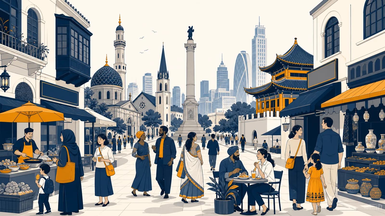
Cultural geography is a branch of human geography that explains how beliefs, languages, identities, customs, and ways of life create spatial patterns, in the context of people and places. It asks what cultural geography is, how culture spreads, why cultural regions form, and how a cultural landscape records human choices. The field exists because people do not use space in identical ways: shared meanings affect where they settle, what they build, which borders they recognize, and how they respond to change.
A street can reveal these processes before anyone says a word. Shop signs identify languages. A place of worship marks a community's presence. Food businesses connect local demand to distant farming regions and trade routes. A monument tells an approved public story, while graffiti may challenge it. Cultural geography turns such observations into evidence about who uses a place, how that use developed, and whose version of the place has authority.
What cultural geography actually is
Cultural geography studies the relationship between culture and space: how groups give meaning to places, how cultural practices vary across areas, and how those practices alter environments. It treats culture as something people learn, share, contest, and change rather than something fixed at birth.
Culture includes learned systems of meaning and practice, such as language, religion, food customs, music, clothing, family expectations, ideas about nature, and rules of public behavior. A cultural trait is one element, such as speaking Welsh or preparing rice in a particular way. A cultural complex is a connected set of traits, such as the tools, skills, rituals, land rights, and trading practices involved in a fishing tradition.
Geographers add a spatial question to the study of culture. They ask where a trait occurs, what boundaries surround it, which routes carry it, and how its meaning changes in a new location. A distribution on a map is a beginning, not an explanation. Two areas may share a language but use it differently in schools, courts, homes, and online spaces.
Culture is learned, not biologically inherited. A child usually acquires language, manners, food preferences, and ideas about appropriate behavior through family, institutions, peers, media, and daily participation.
The word place means more than a point on Earth. A place is a location invested with meaning. One city square can be a workplace for a vendor, a heritage site for officials, a gathering point for protesters, and an inconvenient obstacle for commuters. Cultural geography examines how those meanings coexist and how power determines which uses receive protection.
Culture operates at several scales
Cultural patterns can be studied at the scale of a household, neighborhood, city, region, state, or global network. Scale changes what becomes visible. A national map may show one dominant language, while a neighborhood survey reveals multilingual households and different languages used by different generations.
Scale also prevents a common error: treating a large category as uniform. A label such as “Latin American,” “Muslim,” or “rural” includes people with varied histories and practices. Good cultural geography specifies the location, scale, evidence, and particular cultural feature being discussed.
How cultural traits become spatial patterns
Cultural traits become spatial patterns when repeated human choices are concentrated, connected, or restricted across space. Households transmit practices, institutions standardize them, networks carry them, and laws or physical barriers shape where they can continue. The resulting pattern can have a core, boundary, and transition zone.
Consider a language. Parents may teach it at home. Schools may use it for instruction, governments may print forms in it, broadcasters may extend its daily reach, and employers may reward fluency. If those supports cluster in one area, the language becomes visible on signs and audible in public life. If speakers disperse and institutions do not support the language, use may retreat into homes or ceremonial settings.
This pipeline is not automatic. People abandon, revive, combine, or reinterpret practices. A traditional building method may decline when materials become expensive, then return because local rules protect historic streets. A food associated with one group may be adopted widely, altered for new ingredients, and marketed with a different meaning.
Cultural regions have more than one kind of boundary
A formal cultural region is defined by a measurable shared trait, such as an area where a particular language is spoken by many residents. Its edge depends on the threshold selected, so different maps can draw different valid boundaries from the same data.
A functional cultural region is organized around a node. The circulation area of a regional newspaper, the audience of a local radio station, or the territory served by a pilgrimage center can create such a region. Connections usually weaken with distance from the node.
A perceptual region, also called a vernacular region, exists because people recognize and name it. “The South” in the United States is an example, but its boundary shifts according to the speaker and the feature being considered. Perceptual regions are real social facts even when they lack official borders.
| Region type | What holds it together | How to test it |
|---|---|---|
| Formal | A shared, mapped trait | Choose a measure and threshold |
| Functional | Movement around a node | Trace flows, service areas, or contacts |
| Perceptual | Shared recognition and naming | Compare surveys, speech, media, and mental maps |
How cultural diffusion works
Cultural diffusion works when a trait moves through contact, communication, migration, trade, or institutions. Geographers distinguish relocation diffusion, which travels with people, from expansion diffusion, which spreads through a population while remaining strong near its source. Barriers and adaptation shape both forms.
Find the place or network where the practice is produced, taught, or organized. A source can be a neighborhood, an institution, or a dispersed online community.
People, merchants, teachers, religious workers, governments, broadcasters, and digital platforms can all move cultural information.
Roads, shipping links, family networks, schools, and media channels determine which places encounter the trait first and most often.
Receiving communities may accept the trait, reject it, or adapt it to local rules, tastes, materials, and beliefs.
Evidence appears in behavior, vocabulary, buildings, businesses, laws, or new links between places.
Relocation diffusion occurs when carriers move. A family may bring a language, recipe, musical style, or religious practice to a new city. The source area can retain the trait, lose some practitioners, or change through continued contact. The spatial mechanics of these movements are examined more closely in how migration reshapes places.
Expansion diffusion occurs when information spreads outward without requiring the original population to relocate. Contagious diffusion passes through frequent direct contact, often reaching nearby people first. Hierarchical diffusion moves through ranked nodes, such as major cities, celebrities, schools, or company offices. Stimulus diffusion carries the underlying idea while the exact practice changes.
A restaurant opens near a university and serves a regional dish. Students post it online, a chef in another city copies the basic idea with locally available ingredients, and a supermarket later sells a packaged version. The dish has moved through a city node and media network, while its recipe and social meaning have changed.
Distance still matters, even with fast communication. People are more likely to adopt a practice when it arrives through a trusted contact, fits existing habits, can be afforded, and is permitted by local institutions. Digital access also has a geography because cables, electricity, language skills, platform rules, and income are unevenly distributed.
Culture versus nationality
Culture is a learned set of practices and meanings, while nationality is a legal or political relationship to a state, sometimes also used as an identity. The categories can overlap, but no passport guarantees one language, religion, ethnicity, diet, or sense of belonging.
Usually recorded through citizenship or claimed connection to a nation. It can affect voting, residence rights, passports, and legal protection.
Learned through participation and expressed in many domains. A person can take part in several cultural communities at once and behave differently across settings.
Ethnicity is another related but distinct idea. It refers to an identity based on a claimed shared ancestry and history, often linked with language, religion, homeland, or custom. Race is a social classification that assigns meaning to perceived physical differences. Racial categories vary by place and historical period, which shows that the labels are political and social constructions rather than neat biological divisions.
Confusing these terms produces bad maps and harmful assumptions. A national border does not contain one culture. A cultural boundary may cross several states. A person can be legally Canadian, identify as Punjabi, speak English at work, use Punjabi with relatives, and take part in religious and professional communities that link distant cities.
Identity is also situational. The aspect a person emphasizes can change with location and audience. This does not make identity false. It shows that identities organize relationships. A regional accent may be ordinary at home, muted during a job interview, and emphasized at a sports event.
How cultural landscapes show up in the built environment
A cultural landscape is the visible result of people modifying and interpreting an environment through buildings, fields, roads, signs, sacred sites, monuments, and land divisions. Reading it means connecting physical features to the practices, technology, authority, and history that produced them.
The same physical setting can support very different landscapes. A steep hillside might hold terraces built for farming, detached houses reached by winding roads, protected forest, or a quarry. Each outcome depends on available knowledge, property rules, labor, markets, beliefs about nature, and government decisions.
Buildings encode use and authority
Architecture records what a society expects people to do. A house plan can separate guests from family life. A wide ceremonial avenue can display state power. A market with small stalls supports different transactions from a warehouse district built for trucks. Materials also locate a building within supply networks: stone may come from nearby ground, while steel and glass connect the site to industrial production.
Preservation creates another layer. Officials choose which buildings count as heritage and which changes are allowed. That choice can protect memory and skilled craft, but it can also raise costs or freeze one period as the official image of a neighborhood. Residents may disagree about whose history deserves a plaque, a museum, or public funding.
Names and monuments claim space
A place name is a compact statement about language, memory, and control. Colonizing governments have often replaced Indigenous names, while later campaigns have restored older names or selected new ones. Street names and statues perform similar work. Renaming does not alter coordinates, but it changes which story people repeatedly encounter.
This sentence is a summary, not a claim that every feature was consciously planned. Landscapes accumulate through many decisions. A wall built for security can later become a heritage attraction. A former factory can become apartments. Each reuse preserves some evidence, removes other evidence, and gives the site a new audience.
How cultural geography shows up in work, law, and daily decisions
Cultural geography appears whenever a decision depends on how a group uses, values, or interprets a place. Planners, teachers, public health teams, lawyers, businesses, journalists, and conservation workers use cultural evidence to predict behavior, avoid exclusion, and explain conflict over space.
City planning turns cultural practice into design choices
A planner deciding where to place a public market needs more than population totals. The planner must know when traders operate, how customers travel, what foods require refrigeration, which groups need translated information, and whether informal selling already occupies the site. A clean geometric plan can fail if it removes the social network that made the market useful.
Housing design also meets culture. Household size, multigenerational living, cooking methods, privacy expectations, and access to shared outdoor space affect whether a dwelling works. These preferences are not permanent rules for a group. They are questions to investigate through observation and consultation. The broader arrangement of homes and services is covered in how settlements take shape across space.
Law decides which cultural claims receive protection
Courts and governments encounter disputes about sacred land, language access, burial sites, traditional resource use, religious clothing, and the return of cultural objects. A legal boundary may cut across an older cultural territory. Evidence can include oral history, maps, land use, archival records, and continuing practice.
Law can preserve a cultural landscape by limiting demolition or protecting access. It can also displace culture through compulsory acquisition, zoning, or rules that treat informal activities as if they have no value. Cultural geography helps expose the spatial effects of a rule: who gains access, who travels farther, and whose activity becomes invisible.
Businesses map meaning as well as demand
A supermarket selecting products needs to understand local food practices, household budgets, religious requirements, and seasonal celebrations. Translation alone is insufficient. Package size, ingredients, placement, and trust in a brand all affect adoption. Companies that copy a symbol without understanding its sacred or political meaning can cause offense and damage their reputation.
Location choices also link cultural and commercial patterns. A cluster of specialist shops can attract customers from a wide region because each shop benefits from the others. To separate purchasing power and employment from cultural preference, compare this topic with the geography of production, trade, and wealth.
A sound location decision checks all three. A building may have enough floor space, good transport connections, and the wrong social meaning. A former prison, cemetery, or disputed monument cannot be evaluated as an empty parcel because past use affects present acceptance.
How language, religion, and identity interact with place
Language, religion, and identity interact with place by organizing communication, community institutions, sacred meanings, and access to services. They often overlap spatially, but each has its own distribution and internal differences. Mapping one as a substitute for the others produces false conclusions.
Language connects speakers and can mark social boundaries. A dialect may signal region, class, age, or membership in a community. Governments influence its geography through school policy, official documents, broadcasting, and recognition of place names. Families influence it through daily use. Media can connect speakers who live far apart.
Religion gives particular places sacred status and organizes movement through weekly worship, festivals, pilgrimage, burial, and dietary practice. Sacred space can be as small as a household shrine or extend across a mountain, river, or homeland. A site may be sacred to more than one group, which can produce shared use, negotiated schedules, or conflict.
Identity draws on these practices without following a simple formula. Two people who share a religion can speak different languages and hold different political views. Two speakers of one language can belong to different national communities. Cultural geographers therefore avoid treating a single marker as a complete identity.
Power affects which identity is visible. A majority language may appear on every official sign while a widely used minority language remains absent. A religious building may be prominent, hidden, or prohibited by planning rules. Visibility is evidence about authority, not a direct measure of how much a community matters to its members.
How globalization changes local cultures
Globalization changes local cultures by increasing flows of people, goods, money, images, and ideas across long distances. It can spread similar products and media, yet local groups select and modify what arrives. The outcome is often hybrid culture rather than complete sameness or isolation.
A global restaurant chain may use a standard logo and operating system while changing ingredients, menus, seating, or advertising to suit local expectations. This process is sometimes called glocalization. The global organization gains a recognizable identity, and the local branch translates that identity into a form customers will accept.
Cultural mixing can produce new music, vocabulary, fashion, and food. It can also produce unequal exchange. A company with a large distribution network can make one version of a culture more visible than versions maintained by smaller communities. Tourism may provide income for craft workers while encouraging them to alter objects for buyers who expect a simplified tradition.
Homogenization, resistance, and hybridization can occur at the same time. A teenager might use the same platform as millions of people, post in a regional language, follow a local religious calendar, and remix music from several countries. The device is standardized, but the cultural practice is not.
Global contact replaces local differences with one uniform culture.
Global forms enter places with existing languages, laws, tastes, inequalities, and institutions. People adopt them selectively and produce uneven results.
Transport and communication networks determine who can participate in these exchanges and at what cost. Ports, airports, roads, broadband links, and delivery systems make some cities major cultural gateways. Their routes also determine which places receive new products and cultural information first.
Four mistakes people make with cultural geography
Most errors in cultural geography come from treating groups as uniform, mistaking correlation for cause, assuming mapped boundaries are sharp, or describing culture as timeless. Each mistake hides variation and power. Better analysis states the scale, identifies evidence, compares explanations, and checks how patterns changed.
1. Treating every member of a group as the same
A category summarizes; it does not predict every individual. Age, class, gender, occupation, location, personal belief, and family history create differences within any cultural group. Replace “this group does X” with a precise claim about which people, practice, place, evidence, and time period are involved.
2. Assuming nearby events have one cultural cause
A map may show that a voting pattern overlaps with a language region, but overlap alone does not prove that language caused the vote. Income, urban residence, age, education, party organization, and local issues may contribute. Compare alternative explanations and seek evidence at the level where people made decisions.
3. Drawing hard lines around gradual change
Many cultural traits fade across transition zones rather than stopping at a border. Census categories and map colors can create sharp edges that daily life does not contain. Inspect the measurement rule. A map of the most common home language hides second languages and close minorities.
4. Freezing a culture in the past
Traditions are repeated choices, not untouched objects. People maintain them, argue about them, adapt materials, and assign new meanings. Calling one period “authentic” can give museums, governments, or tourists more authority than living practitioners. Ask who defines authenticity and what that definition permits.
A cultural map is an argument built from categories. Always check who collected the data, which options respondents received, what scale is shown, and which mixed or missing identities disappeared during classification.
How do cultural geographers study a place?
Cultural geographers study a place by combining observation, interviews, maps, documents, images, demographic data, and records of movement or land use. They compare sources because official categories, personal accounts, and visible features answer different questions and contain different biases.
Field observation can record languages on signs, building uses, pedestrian activity, memorials, boundaries, sounds, and changes across time. Interviews explain meanings that cannot be read directly from a wall or map. Archives show earlier land ownership, policies, photographs, newspapers, and plans. Spatial data can reveal clustering and connections.
A simple investigation of a shopping street might proceed block by block. Record each ground floor use, the languages visible outside, opening hours, and evidence of religious or regional specialization. Then interview willing owners about customers and supply routes. Compare these findings with rent, transport, and planning records before explaining the pattern.
Ethics matters because research represents real communities. People should understand how their words or images will be used. Sensitive sites may need to remain unmapped. Researchers must also consider their own position: a visitor, resident, official, or fluent speaker will notice different things and gain different access.
Are cultural boundaries the same as political borders?
Cultural boundaries are not the same as political borders. Political borders define state jurisdiction, while cultural boundaries mark changes in language, identity, religion, custom, or perceived belonging. A cultural boundary can cross a state line, follow it, lie inside it, or remain a broad transition zone.
States often try to align territory with a national identity through education, official language rules, ceremonies, media, and maps. Yet populations move and border regions sustain ties on both sides. A border can separate relatives politically while shared markets, speech, and festivals continue to connect them culturally.
The mismatch matters in news and law. A claim that a political border contains one people may erase minorities or justify control over disputed territory. Cultural evidence can explain attachments to land, but it does not by itself settle sovereignty. Legal agreements, security, resources, and competing histories also shape border disputes.
Does digital culture still have a geography?
Digital culture still has a geography because online activity depends on physical infrastructure, legal jurisdictions, language communities, working hours, income, and location based networks. A message can travel globally, but access, visibility, moderation, and meaning remain uneven across places.
Servers occupy buildings and use electricity. Cables cross oceans and borders. Governments can block services or demand that companies follow local rules. Platforms recommend content partly through language, social connections, and location. Creators work within local labor markets and time zones even when their audience is dispersed.
Online communities also create places of their own. Members establish boundaries through passwords, moderation, vocabulary, and shared memory. These spaces are not identical to physical places, but they connect back to them when users arrange meetings, send goods, collect money, influence elections, or direct attention to a neighborhood.
Cultural geography makes human patterns readable
Cultural geography explains why human landscapes differ even where climate and terrain are similar. It connects visible patterns to learned practice, movement, institutions, and power. Used carefully, it helps separate evidence from stereotype and shows that every mapped category is a choice.
The next time you cross a familiar street, notice one sign, building, boundary, or repeated activity. Ask who produced it, which network sustains it, how long it has been there, and who might interpret it differently. That small exercise turns scenery into geographic evidence.
The takeaway: Culture becomes geographic when learned meanings and practices shape the use of space. To explain the pattern, trace the people, routes, institutions, adaptations, and power behind what appears on the ground.
Those questions also connect cultural evidence with climate, population, cities, resources, and movement. See how people and environments fit into geography as a whole to place this topic beside the subject's other ways of explaining Earth.