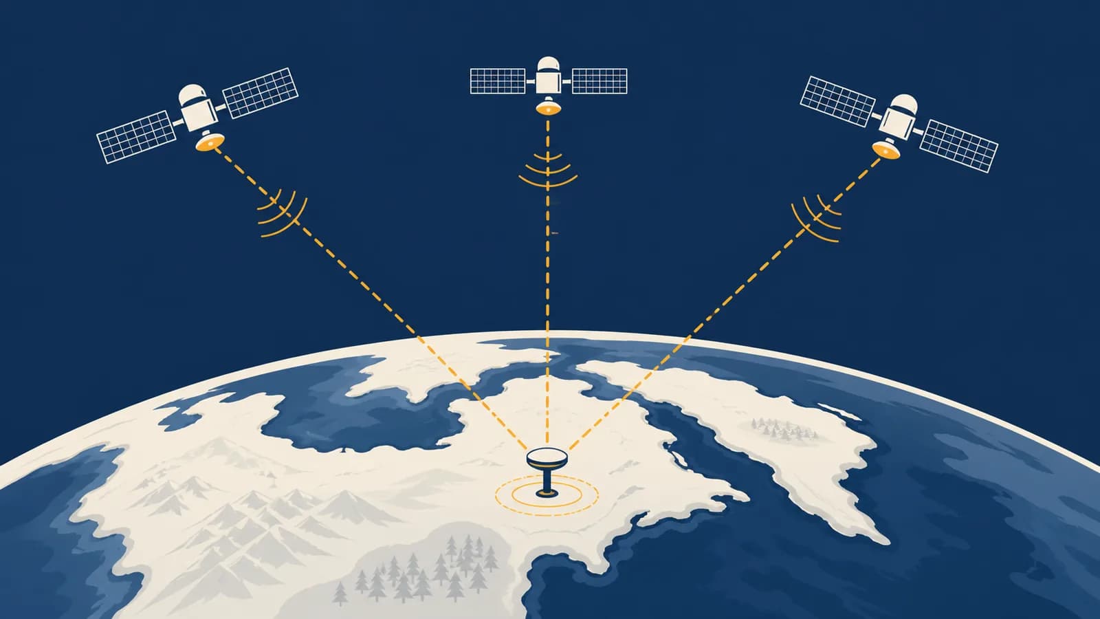
Global Positioning System (GPS) is a satellite-based radio navigation system that calculates position, speed, and time anywhere with suitable signal reception, in the context of geographic measurement and navigation. A GPS receiver finds latitude, longitude, altitude, and precise time by measuring signals from several satellites. GPS exists because people need a shared, repeatable way to locate moving or fixed objects without surveying every route or maintaining a local chain of landmarks.
What GPS actually is
GPS is a United States owned positioning, navigation, and timing system made of orbiting satellites, a ground control network, and receivers. Satellites broadcast one-way radio signals; the receiver does the position calculation and sends nothing back to them.
The full name is the Global Positioning System. It is one member of a wider family called global navigation satellite systems, or GNSS. Other GNSS constellations include Galileo, operated by the European Union, GLONASS, operated by Russia, and BeiDou, operated by China. A phone may combine several constellations even though its settings screen uses “GPS” as the familiar name for satellite positioning.
Three linked parts make GPS work:
The baseline constellation defined in the GPS Standard Positioning Service Performance Standard has 24 slots in six orbital planes. The system normally has extra operational satellites, but the exact live count changes as spacecraft are launched, maintained, or retired. Each satellite travels in medium Earth orbit, about 20,200 kilometres above Earth, and circles Earth roughly twice per sidereal day. This arrangement makes at least four satellites visible from nearly any open location.
GPS provides coordinates, not meaning. A receiver can calculate that it is near a certain latitude and longitude. A map database identifies the road at those coordinates, while routing software decides which turn to suggest. This separation explains why the blue dot can be correctly located beside a road that the map has drawn incorrectly.
How a GPS signal carries distance information
A GPS satellite repeatedly broadcasts a coded radio signal containing the sending time and data describing its orbit. A receiver matches the code, estimates how long the signal travelled, and multiplies that travel time by the speed of light to obtain a range.
The measurement is called a pseudorange. It resembles the distance between satellite and receiver, but it initially includes clock error and delays caused by the atmosphere and signal path. “Pseudo” does not mean fake. It means the raw range still contains quantities that the receiver must estimate or correct.
If a signal travels for 0.070 seconds, then metres.
Here is the measured range, is the speed of light in vacuum, and is travel time. The International System of Units fixes at exactly 299,792,458 metres per second. The example gives about 20,985 kilometres, a plausible satellite-to-receiver path.
The timing demand is severe. Light travels about 300 metres in one microsecond. A timing error of only 0.000001 seconds can therefore create roughly 300 metres of range error before other measurements help correct it. Satellites carry atomic clocks, while an ordinary receiver uses a far less expensive clock and treats its clock offset as an unknown.
The receiver does not measure direction to a satellite. It measures signal travel time. Position emerges where several measured ranges fit at once.
Each satellite transmits a distinctive repeating code. The receiver creates the same code internally and slides its copy until the patterns align. The amount of shift reveals the signal delay. The navigation message also supplies orbital information, called ephemeris data, that lets the receiver calculate where the satellite was when it sent that part of the signal.
How GPS works step by step
A receiver identifies visible satellites, obtains their orbital and clock data, measures a pseudorange to each one, and solves simultaneous equations for three position coordinates plus receiver clock error. It then repeats the process to update movement and time.
The receiver listens on navigation frequencies and tests incoming patterns against the published codes assigned to satellites.
It collects the satellite clock correction, orbit details, and a broader summary of the constellation. Fresh detailed orbit data supports an accurate fix.
It compares received codes with its internal copies to estimate each signal’s travel time, then converts the delay into a range.
The receiver model accounts for satellite clock offsets, relativity, atmospheric effects, and Earth’s rotation during signal travel.
It finds the latitude, longitude, altitude, and receiver clock offset that best fit all measured ranges.
New measurements produce later fixes. Differences between them, together with the radio signal’s frequency shift, support speed and direction estimates.
A simplified two-dimensional picture makes the geometry visible. One known transmitter and one exact range put a receiver somewhere on a circle. A second circle usually crosses the first at two points. A third measurement removes the remaining ambiguity. Real GPS operates in three dimensions, so each range defines a sphere rather than a circle.
This geometry is often taught as trilateration because it uses distances rather than angles. With several pseudoranges and a clock offset in the equations, multilateration is the more precise technical term.
The receiver usually has more measurements than the minimum. It can fit a solution to all usable satellites, reject some unhealthy or inconsistent signals, and estimate how uncertain the result is. A moving receiver solves again and again. A navigation app then matches those fixes to a likely road or path, a separate process called map matching.
Why a GPS receiver usually needs four satellites
Four satellites are normally required because the receiver must solve four unknowns: its position along three spatial axes and the error in its own clock. Three ranges can locate a point only if receiver time is already known accurately.
Suppose an ideal receiver had a clock perfectly synchronized with GPS time. Ranges to three known satellite positions could define a three-dimensional location, subject to resolving geometric ambiguity. A phone does not carry an atomic clock. Its small clock can be wrong by an amount that would overwhelm the distance calculation, so the calculation introduces a shared clock bias.
A simplified observation equation for satellite is:
The receiver solves for , , , and clock bias using at least four equations from four satellites.
In this expression, is the unknown receiver position, is a known satellite position, is the measured pseudorange, and is the range error produced by the receiver clock bias. Actual processing adds terms for satellite clock error, atmospheric delay, and other effects.
More satellites do not automatically guarantee a better answer. Their arrangement matters. Four satellites spread widely across the sky give stronger geometry than four clustered in one patch. The link between measurement and spatial pattern is part of how geographers test locations and geographic relationships.
GPS versus maps and GIS
GPS measures position and time, a map presents selected geographic information, and GIS stores, combines, queries, and analyses spatial data. They often appear in one device, but an error in one layer does not prove the others failed.
A coordinate, altitude estimate, time, speed, direction of travel, and information about measurement quality.
Road lines, place names, addresses, traffic rules, search results, route choices, and a visual symbol showing the calculated position.
Consider a driver beside a newly built roundabout. The receiver may correctly calculate the vehicle’s coordinates, while an old map still shows a straight road. The app appears to place the car off-road, then repeatedly reroutes it. That is a database and map-matching problem, not necessarily a satellite positioning problem.
A field ecologist might record GPS coordinates for every sampled tree, attach species and trunk measurements, and import the records into software. The coordinates are only one field in each record. The larger workflow, including layers, queries, buffers, and overlays, belongs to the methods used to build and analyse a GIS.
GPS also differs from a compass. A stationary single-antenna receiver can report location, but it cannot infer the direction the device is facing merely from one point. It can calculate course over ground after movement creates a sequence of positions. Phones often use a magnetic sensor and motion sensors to show orientation while stationary.
How GPS accuracy changes with place and equipment
GPS accuracy changes because buildings, terrain, vegetation, atmosphere, radio interference, satellite arrangement, receiver design, and correction services alter the signals or the solution. Open sky and well-spread satellites usually produce a better fix than an obstructed urban street.
The official GPS accuracy guidance says a GPS-enabled smartphone is typically accurate within a 4.9 metre radius under open sky, while performance worsens near buildings, bridges, and trees. That figure is not a promise for every device or place. The error shown by an app is also an estimate, not a guaranteed boundary.
Blocked signals reduce the available geometry
Earth, roofs, rock, dense structures, and sometimes wet foliage weaken or block the high-frequency radio signals. A receiver in a tunnel cannot see the constellation directly. A receiver in a narrow valley may see satellites only through the strip of sky above, giving an uneven geometric arrangement.
Reflected signals create multipath error
A radio signal may bounce from glass, concrete, water, or metal before reaching the antenna. The reflected path is longer than the direct path, so it looks like extra travel time and therefore extra distance. Urban canyons are difficult because the direct signal may be blocked while reflected copies remain strong.
The atmosphere changes signal speed
The ionosphere, a region containing charged particles, and the electrically neutral lower atmosphere both delay radio signals. Models remove much of the delay. Dual-frequency receivers can compare how two frequencies were affected, allowing a more direct estimate of ionospheric delay because that delay depends on frequency.
Satellite geometry changes uncertainty
Measurement errors combine differently depending on where satellites sit in the sky. A wide spread constrains the receiver from several directions. A cluster gives similar lines of sight and lets the same range errors create a larger position error. Receivers describe this effect using dilution of precision values.
A phone locates you well in an open park, drifts across the street between tall buildings, and loses a direct fix in a station tunnel. The satellites did not suddenly move into poor orbits. Your local signal paths changed.
Surveyors improve results with better antennas, observations on multiple frequencies, longer measurement periods, and corrections from receivers at known coordinates. Real-time kinematic methods compare carrier-phase observations from a base station and a rover. Under suitable conditions and with careful practice, such systems can achieve centimetre-level positioning. The equipment, correction link, reference frame, and quality checks all matter.
How GPS shows up in work, infrastructure, and daily decisions
GPS supports far more than turn-by-turn directions: people use its position and time measurements to survey land, guide machinery, coordinate transport, monitor environmental change, synchronize networks, respond to emergencies, and document where observations were made.
In daily life, a receiver helps a phone attach a location to a photograph, estimate a running route, find a parked vehicle, or report a caller’s approximate position to an emergency service where supported. The app may combine GPS with Wi-Fi observations, mobile network data, accelerometers, gyroscopes, and digital maps. The resulting blue dot is a fused estimate, not always a GPS-only result.
| Setting | What GPS contributes | What else is needed |
|---|---|---|
| Land surveying | Coordinates tied to a reference frame | Control points, correction data, calibrated equipment, and documented methods |
| Farming | Repeated tracks and machine position | Field boundaries, implement controls, crop data, and an operator’s plan |
| Aviation and shipping | Position, course, speed, and precise time | Certified equipment, charts, procedures, and independent safety systems |
| Emergency response | Location of crews, incidents, or callers | Communication networks, address data, dispatch decisions, and local knowledge |
| Earth science | Repeatable station positions and movement through time | Stable monuments, long observations, reference processing, and physical interpretation |
| Telecommunications | A shared precise timing reference | Receivers, disciplined local clocks, network controls, and backup timing sources |
Position records become useful evidence only after someone asks a sound question. Wildlife researchers can tag observation sites, road agencies can inventory signs, and delivery firms can compare planned and actual routes. Coordinates can then be joined to terrain, land cover, property, or population data. Images gathered by aircraft or spacecraft use related location knowledge; how sensors measure Earth from a distance explains that separate process.
Precise time is the less visible service. A fixed GPS timing receiver can align a local clock with the time carried by the system. Telecommunications, electricity networks, financial systems, and scientific instruments use accurate timestamps to order events or coordinate operations. Positioning and timing come from the same signal because distance is inferred from time.
A GPS track is sensitive location data. It can reveal a home, workplace, routine, medical visit, or isolated field site. Collect only what the task needs, limit access, and remove identifying detail before sharing.
Location evidence also needs context. A point can show where a receiver calculated itself to be, within uncertainty. It does not by itself prove who carried the device, what they did there, or why. Investigators and researchers check timestamps, device handling, accuracy estimates, map sources, and independent records before drawing a conclusion.
5 mistakes people make with GPS
Most GPS mistakes come from confusing a calculated position with perfect truth, treating every blue-dot problem as a satellite failure, or ignoring the conditions and reference system behind a coordinate. The following five errors lead to poor navigation and weak evidence.
1. Treating GPS as an exact point
A fix is an estimate with horizontal, vertical, and timing uncertainty. Several fixes taken while standing still may scatter. Record the reported quality, observation conditions, device, and method when the coordinate will support a boundary, experiment, or safety decision.
2. Assuming GPS needs a mobile or internet connection
The satellites broadcast directly to a receiver, so the basic position calculation does not require a mobile data plan. An internet connection can make the first fix faster by supplying assistance data, and it may be needed to download maps, traffic, corrections, or search results. Offline maps plus a working receiver can still support navigation.
3. Blaming GPS for every wrong instruction
A bad turn may come from an outdated road database, an incorrect destination pin, a routing restriction, or map-matching software. Check the raw position against visible features and another map before deciding which part failed.
4. Mixing coordinate formats or datums
Latitude and longitude may be written as decimal degrees, degrees and decimal minutes, or degrees, minutes, and seconds. A datum defines how coordinates relate to Earth. Copying numbers without the format, sign, hemisphere, and datum can move a point. For example, 33.5 degrees is 33 degrees 30 minutes, not 33 degrees 5 minutes.
5. Following the screen when the surroundings disagree
Navigation software cannot see a washed-out bridge, a locked gate, dangerous water, or a new traffic order unless its data includes it. Treat signs, physical conditions, legal restrictions, and trained judgement as primary safety evidence. A calculated route is advice, not authority.
Does GPS work indoors, underground, or without internet?
GPS can work without internet, but it needs radio signals strong enough for the receiver to detect and measure. Indoors or underground, roofs and earth often weaken those signals so much that the device must use other sensors or network-based positioning.
A receiver that has current orbit data and stored maps can calculate its position and display it offline. Without assistance data, a cold start may take longer because the receiver must search for satellites and collect navigation messages from the weak radio stream. The exact delay depends on device state, sky view, and design.
Near windows or under a light roof, some direct or reflected signals may reach a sensitive phone. The result can be unstable because multipath dominates and satellite geometry is restricted. In a deep mine, subway tunnel, or underwater location, ordinary GPS signals usually cannot provide a direct fix. Systems may instead use inertial sensors, surveyed beacons, Wi-Fi positioning, wheel measurements, or signals relayed from the surface.
Satellite positioning can still work. Search, live traffic, map downloads, and assistance services may be unavailable.
A cached map may still display, but GPS cannot make a fresh direct fix. Other sensors may estimate movement for a while.
Water also absorbs these radio signals strongly. A receiver just above the surface can work, while one carried underwater generally cannot. Marine equipment therefore places the navigation antenna above water and sends the computed information to displays elsewhere on the vessel.
Can GPS be jammed, spoofed, or switched off?
GPS reception can be disrupted by radio interference, deliberately jammed with stronger signals, or spoofed with counterfeit signals that produce a false solution. The satellites keep broadcasting, but a local receiver may lose trust in what reaches its antenna.
GPS signals arrive at Earth after travelling more than 20,000 kilometres and are weak at the receiver. A nearby transmitter on or near the same frequencies can cover them. Jamming usually causes loss of reception or degraded accuracy. Spoofing is more deceptive: crafted signals imitate satellites and try to pull the receiver’s time or position away from reality.
Good practice depends on the stakes. A hiker can compare the screen with terrain, compass direction, and a paper map. A ship, aircraft, power network, or scientific observatory needs designed monitoring, independent sensors, trained procedures, and a response plan. Sudden impossible speed, many satellites changing together, conflict with inertial sensors, and identical positions across separated antennas can all be warning signs, but detection methods vary.
The United States ended the intentional degradation of standard civilian GPS accuracy, called Selective Availability, in May 2000. That historical policy is different from local interference, equipment faults, satellite maintenance, or a map error. It is also different from the possibility that access to a radio service may be limited in a conflict. Safety-critical users plan for failures instead of assuming continuous perfect reception.
GPS turns time into geographic evidence
GPS is a geographic tool because it connects an observation to a shared position, reference frame, and time. Its value comes from measuring those quantities transparently, checking their uncertainty, and combining them with maps, field evidence, and informed judgement.
The next time a blue dot moves, separate the chain in your mind: atomic clocks and orbital data shape a radio message; signal delays become pseudoranges; several pseudoranges become coordinates; software places those coordinates on a map; a person decides what to do. Each link can be tested.
Try a small field check in an open, safe place. Record ten fixes while standing still, note the reported accuracy and sky conditions, then plot the coordinates. Repeat beside a tall building and compare the spread. The exercise turns “GPS error” into an observable geographic pattern with possible causes.
The takeaway: GPS does not ask satellites where you are. A receiver listens to precisely timed broadcasts, estimates several distances, solves for its own position and clock error, and passes the result to whatever map or system needs it.
That habit of separating measurement, representation, analysis, and decision-making carries across the wider study of geographic places, patterns, and tools. Notice not only where a device says you are, but also how it knows, what could disturb the evidence, and which human decision follows.