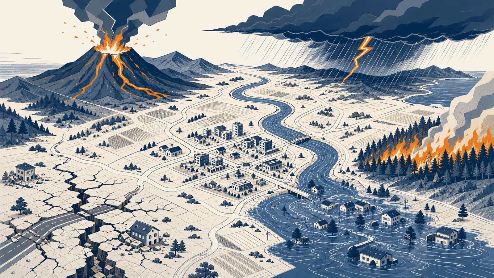
Natural disasters are severe disruptions that occur when natural hazards strike exposed and vulnerable people, buildings, infrastructure, or ecosystems, in the context of physical and human geography. Earthquakes, floods, hurricanes, tsunamis, volcanic eruptions, droughts, wildfires, and landslides become disasters through this meeting of physical processes and human risk. The idea exists because naming the hazard alone cannot explain the damage: geography must also ask who and what lay in its path, how well they were protected, and how quickly they could recover.
What a natural disaster actually is
A natural disaster is the damaging result of a natural process interacting with an exposed community that cannot fully resist or recover from it. The process supplies the hazard, while settlement patterns, building quality, preparedness, and inequality shape the scale of the disaster.
A hazard is a possible source of harm. An earthquake beneath an uninhabited desert is a geophysical hazard, but it may cause no disaster. The same ground motion beneath a dense city can collapse buildings, break water mains, cut electricity, start fires, and stop hospitals from functioning. The shaking is natural. The chain of consequences depends heavily on human decisions.
A hazard does not automatically become a disaster. Damage requires something valuable to be exposed, and serious disruption is more likely where people and systems are vulnerable.
Geographers often separate disaster risk into four connected ideas:
- Hazard: the potentially damaging event or process, such as a flood or ash fall.
- Exposure: the people, property, roads, farms, and services located where the hazard can reach.
- Vulnerability: the conditions that make exposed people or assets easier to harm, such as weak masonry, poor drainage, illness, or a lack of savings.
- Capacity: the ability to prepare, respond, adapt, and recover, including warning systems, emergency services, trusted local networks, insurance, and safe construction.
The word natural describes the triggering process, not every cause of the final loss. A river may rise after intense rain, but paving a floodplain removes surfaces that once absorbed water. A cyclone may bring the same wind speed to two settlements, yet building codes and evacuation access can produce very different outcomes.
How does a hazard become a disaster?
A hazard becomes a disaster through a sequence: a physical event reaches an exposed place, vulnerable systems fail, immediate damage interrupts essential services, and secondary effects spread. Preparedness and response can break this sequence before disruption exceeds the community's ability to cope.
Consider heavy rain over a river basin. Water reaches the channel by falling directly into it, flowing across the surface, and moving through soil and groundwater. If inflow exceeds the amount the channel can carry, the river overtops its banks. Homes on the floodplain are exposed. Ground-floor electrical systems, unprotected wells, and a single road bridge increase vulnerability. Raised buildings, upstream gauges, evacuation routes, and shelters increase capacity.
Fault rupture releases seismic energy, a storm transfers heat and moisture, or gravity pulls saturated soil downslope.
Shaking crosses a city, floodwater enters a settlement, or ash moves across an air route and farming district.
Walls crack, drainage backs up, crops lose water, communications stop, or a hospital loses access and power.
A closed port delays food and fuel, a damaged substation darkens areas beyond the impact zone, and contaminated water raises disease risk.
Rescue, temporary housing, repairs, financial help, and reconstruction determine how long disruption lasts and who can return.
This chain explains why disaster reports separate direct and indirect effects. A collapsed warehouse is direct physical damage. Lost wages while the warehouse is closed are an indirect economic effect. Displacement can become a long social effect if rent rises or reconstruction excludes former residents.
How do earthquakes, volcanoes, and tsunamis work?
Tectonic hazards begin with heat driven movement inside Earth and stress in its crust. Sudden fault slip produces earthquakes, rising magma can produce eruptions, and rapid displacement of seawater can launch tsunamis whose waves grow as they enter shallow coastal water.
Earthquakes release stored strain
An earthquake occurs when rock suddenly slips along a fault after stress overcomes friction. The rupture sends seismic waves through Earth. Body waves travel through the interior, while surface waves move along the crust and often produce strong side-to-side or rolling motion near the ground.
Damage does not follow magnitude alone. Distance from the rupture, depth, duration, soil, slope, and construction all matter. Soft sediment can amplify some shaking. Waterlogged loose sediment can lose strength during shaking, a process called liquefaction. Unreinforced masonry tends to fail differently from a flexible steel frame.
Volcanoes move magma, gas, and broken rock
A volcanic eruption occurs when magma and dissolved gases rise through weaknesses in the crust and reach or approach the surface. Runny basaltic magma can feed lava flows. More viscous, gas-rich magma can trap pressure and fragment into ash, blocks, and fast pyroclastic flows.
The most dangerous volcanic effect is not always lava. Ash can load roofs, irritate lungs, damage machinery, contaminate water, reduce visibility, and disrupt aviation. Pyroclastic flows are hot mixtures of gas and rock fragments that race down slopes. Lahars form when water mixes with ash and debris, then follows valleys like wet concrete.
Tsunamis move an entire water column
A tsunami is a series of long waves produced by sudden displacement of a large volume of water, commonly during an undersea earthquake that moves the seabed vertically. Submarine landslides and volcanic activity can also generate tsunamis.
In deep ocean water, a tsunami can travel rapidly with a long wavelength and a small visible height. Near shore, friction slows the wave while its energy is compressed into shallower water. Water level and current then rise with destructive force. The first arrival may not be the largest, and a trough can arrive before a crest, making a sudden coastal withdrawal a natural warning.
You feel long or strong shaking near the coast, then see the sea withdraw unusually far. Do not wait to photograph it or for an official message. Move inland or to high ground because the earthquake and withdrawal are natural tsunami warnings.
Plate boundaries connect these processes, but they do not explain every event. Many earthquakes occur along faults within plates. Some volcanoes form above mantle hot spots. The global pattern still makes sense geographically: hazards cluster where crustal stress, melting, and elevation differences concentrate energy.
How do storms, floods, droughts, wildfires, and landslides work?
Weather and surface hazards work by moving heat, water, air, sediment, and vegetation through connected Earth systems. A disturbance becomes extreme when energy or material accumulates faster than the local environment and human systems can absorb, drain, resist, or safely release it.
Tropical cyclones feed on warm ocean water
A tropical cyclone is a rotating low-pressure storm that draws energy from warm, moist ocean air. Rising water vapour cools and condenses, releasing latent heat that supports more uplift and lowers surface pressure. Air flows inward and is turned by Earth's rotation, organising thunderstorms around the centre.
Its hazards include destructive wind, intense rain, high waves, and storm surge. Storm surge is an abnormal coastal water rise driven mainly by winds pushing water toward shore, with low atmospheric pressure adding a smaller contribution. Coast shape, seabed depth, tide, and protective wetlands affect how far the water reaches. The wider processes behind rainfall and atmospheric circulation are developed in how climate systems produce weather patterns.
Floods begin with a water balance
A flood occurs when water covers land that is normally dry. River floods follow excess flow in a channel. Flash floods rise quickly after intense rain or sudden release. Coastal floods come from surge, waves, tides, or tsunamis. Surface-water floods occur when rain exceeds infiltration and drainage capacity.
If a storm supplies 100 mm of precipitation, 25 mm evaporates or returns to the air, and storage rises by 15 mm, then 60 mm remains as runoff: .
This balance is simplified, but it shows the mechanism. Saturated soil leaves less room for storage. Concrete speeds surface flow into drains. Deforestation can reduce interception and alter soil structure. Reservoirs, wetlands, permeable ground, and functioning drains can delay or store water. These links are easier to see alongside the movement and management of water resources.
Drought develops slowly but spreads widely
Drought is a sustained shortage of water relative to normal conditions and demand. Meteorological drought begins with unusually low precipitation. Agricultural drought appears as insufficient soil moisture for crops. Hydrological drought affects rivers, reservoirs, and groundwater, often after a delay.
Heat increases evaporation and plant water loss. High demand can turn a rainfall shortage into a sharper supply problem. Because drought has no single starting moment or boundary, officials track rainfall, soil moisture, river flow, groundwater, vegetation, and stored water rather than waiting for one dramatic signal.
Wildfires and landslides need fuel or unstable slopes
A wildfire spreads when heat, oxygen, and fuel sustain combustion. Dry vegetation, strong wind, steep slopes, and connected fuels can accelerate spread. Ignition may come from lightning or human activity. Fire weather affects behaviour, but land management and settlement at the edge of flammable vegetation shape exposure.
A landslide is the downslope movement of rock, soil, or debris under gravity. Rain can add weight and raise water pressure between grains, reducing friction. Earthquakes can shake loose unstable material. Cutting into a slope can remove support, while fire can remove vegetation and leave soil exposed to later rain.
Hazard versus disaster separates the trigger from the loss
A hazard is an event or process with the potential to cause harm; a disaster is the severe disruption that results when harm overwhelms a community's capacity to cope. Keeping the terms separate prevents natural processes from being treated as complete explanations for human loss.
A river has a stated chance of reaching a certain level at this location. This describes a physical possibility and its likelihood.
If the river reaches that level, homes, a clinic, and an access road may flood. This combines likelihood with exposure and consequences.
Risk is also different from certainty. A high-risk zone is not guaranteed to be damaged this year. A low-risk zone is not guaranteed to remain safe. Risk expresses a combination of possible events and possible consequences over a period of time.
| Term | Question it answers | Flood example |
|---|---|---|
| Hazard | What damaging process could occur? | The river may overtop its banks. |
| Exposure | What lies in the affected area? | Homes, fields, a school, and a road. |
| Vulnerability | What makes loss more likely or severe? | Low floors, weak walls, no vehicle, and contaminated wells. |
| Capacity | What can reduce harm and support recovery? | Warnings, raised utilities, shelters, savings, and emergency crews. |
| Disaster | What serious disruption actually results? | Evacuation, damaged services, lost income, and long recovery. |
The distinction changes policy. If officials treat floods as unavoidable acts of nature, they may focus only on barriers and rescue. If they examine risk, they can also change zoning, protect upstream storage, maintain drains, raise buildings, improve warnings, and help households that cannot afford protective work.
How do scientists measure and compare natural hazards?
Scientists compare hazards with measurements suited to each process, such as earthquake moment magnitude, wind speed, rainfall, river discharge, drought indicators, or burned area. They also map intensity and consequences, because one source value cannot describe every local experience or loss.
Earthquake magnitude estimates energy released at the source. The moment magnitude scale is logarithmic. An increase of one whole magnitude corresponds to ten times the recorded wave amplitude and about 31.6 times the energy release. Intensity is different: it describes shaking and effects at a particular place, so one earthquake produces many local intensity observations.
For a magnitude difference of 2, the ratio is . The larger event releases about 1,000 times as much energy.
Flood specialists measure rainfall over time, water level, flow velocity, and discharge. River discharge is the volume passing a cross-section each second. In a simplified rectangular channel, discharge can be estimated from area and average velocity.
A channel cross-section of 20 m² with an average velocity of 3 m/s carries .
Different scales answer different questions. The Saffir-Simpson Hurricane Wind Scale classifies hurricanes by maximum sustained wind, but it does not include storm surge, rainfall flooding, or tornadoes. A lower-category storm can still produce disastrous water hazards. Drought indices may combine precipitation and evaporation, while reservoir managers also need actual storage and demand.
Good comparison therefore begins by checking what a number measures, where it applies, and what it excludes. Deaths, damaged buildings, economic loss, displaced people, ecosystem change, and recovery time are different consequence measures. Combining them into one ranking can hide who suffered and why.
How do risk maps, forecasts, and warnings reduce harm?
Risk systems reduce harm by locating possible impacts, detecting developing hazards, estimating where and when they may arrive, and sending instructions that people can act on. Their value depends on accurate data, clear uncertainty, trusted communication, and practical access to safer places.
A hazard map may show expected flood depths, shaking intensity, lava paths, landslide susceptibility, or coastal inundation. Analysts combine observations with terrain models, geology, land cover, and process simulations. A risk map adds people and assets, sometimes including building type, age, mobility, income, or access to services.
Forecasting time differs by hazard. Meteorologists can track a tropical cyclone for days, although its exact path and intensity remain uncertain. River gauges can provide hours or days of warning downstream. Earthquake early warning is not prediction: sensors detect a rupture after it starts and may send an alert before the strongest waves reach more distant places. Near the epicentre, warning time can be very short or absent.
A flood alert tells residents to leave by 6 p.m. One household receives it in a familiar language and drives to relatives on higher ground. Another has no car, cannot leave medication behind, and finds the bus route cancelled. The same forecast creates different safety because capacity differs.
Warnings should state the hazard, affected area, timing, expected effects, and action. Probability cones and colour bands can be misread as hard boundaries, even though effects occur outside them. Emergency managers therefore pair maps with plain instructions and repeat messages through phones, radio, sirens, officials, schools, and local organisations.
Mitigation acts before impact. Land-use planning can keep new buildings away from floodways and unstable slopes. Construction standards can make structures resist shaking or wind. Wetlands and dunes can reduce some coastal energy, although they cannot stop every extreme event. Retrofitting, fuel management, drainage maintenance, and backup power address different failure points.
How do natural disasters show up in work and public decisions?
Natural-disaster knowledge guides decisions in engineering, emergency management, insurance, medicine, farming, logistics, journalism, law, and local government. Each field translates physical hazard information into choices about location, design, warnings, budgets, responsibility, continuity, and recovery.
Engineers and planners design for loads and locations
Structural engineers calculate how buildings respond to horizontal shaking, wind pressure, water, fire, and debris. Civil engineers size drains and bridges using expected flows plus safety allowances. Geotechnical engineers test soil and slopes. Planners decide where housing, hospitals, industrial sites, evacuation routes, and open space can safely go.
A code does not make a building invulnerable. It sets a performance target under defined conditions. Older buildings may predate current rules, and enforcement matters as much as written standards. Inspectors, builders, owners, and lenders all affect the result.
Emergency teams turn forecasts into operations
Emergency managers prepare evacuation zones, shelter plans, public messages, supply contracts, and exercises. During an event, they combine reports from sensors, field crews, hospitals, utilities, and residents. Decisions have timing costs: evacuating too late risks lives, while evacuating a wide area too often can reduce trust and strain vulnerable households.
Businesses trace hidden dependencies
A shop may escape physical damage and still close because card payments fail, staff cannot travel, refrigeration loses power, or a supplier's warehouse floods. Continuity planning identifies these dependencies, establishes backups, protects records, and decides which functions must resume first.
The detour example shows how damage propagates through a network. The road itself may be open on both sides of the river, yet one failed bridge changes fuel use, delivery time, staff access, and ambulance coverage. Network geography helps organisations find single points of failure before an emergency.
Law, insurance, and news shape recovery
Law determines building duties, evacuation authority, land ownership, worker protection, and access to public aid. Insurance prices and transfers some financial risk, but coverage limits, exclusions, deductibles, and claim evidence matter. Journalists interpret forecasts, verify official claims, locate affected communities, and avoid turning uncertain model output into false certainty.
Farmers use rainfall outlooks, soil moisture, water allocations, crop choices, fire conditions, and livestock plans to manage risk. Because soil controls infiltration, root water, erosion, and slope behaviour, how soils shape farming and water movement is part of disaster planning rather than a separate concern.
Four mistakes people make with natural disasters
Four common mistakes are treating every hazard as a disaster, reading probability as a schedule, assuming the largest physical event causes the largest loss, and blaming nature for every consequence. Each error hides a decision that can change exposure, vulnerability, or capacity.
1. Calling every extreme event a disaster
An eruption on an uninhabited island may be large without seriously disrupting a community. Calling it a disaster confuses physical size with human consequence. Scientists still study the event as a hazard, and aircraft or ecosystems may be exposed, but the label should follow the actual disruption.
2. Treating probability like a timetable
A 1 percent annual chance does not mean an event happens exactly once per century. Each year presents another chance under the assumed conditions. Probability also changes when channels, coastlines, land cover, climate, or measurement records change.
3. Assuming the strongest event causes the greatest loss
A moderate earthquake close to vulnerable buildings can kill more people than a much larger earthquake far from settlements. A cyclone's wind category cannot tell you its full flood impact. Compare exposure and construction as carefully as magnitude, wind, or rainfall.
4. Describing all damage as natural
Rain is natural, but blocked drains are maintained or neglected by people. Fault movement is natural, but unsafe additions to a school are human decisions. This does not mean every loss has one person to blame. It means causes can be traced, and some can be changed.
Natural processes create hazards; geography helps explain who is exposed, what fails, and what can be changed. Careful language improves action by directing attention toward safer construction, fair warnings, accessible evacuation, protected ecosystems, and recovery support. It also keeps scientific uncertainty separate from political choices about acceptable risk.
Can natural disasters be prevented?
Most natural hazards cannot be stopped, but many disasters can be prevented or made less severe by reducing exposure and vulnerability. Safe sites, resistant buildings, ecosystem protection, early warning, evacuation, education, and social support interrupt the path from event to catastrophic disruption.
No measure works against every intensity. A levee may reduce frequent river flooding but encourage development behind it, leaving severe consequences if water overtops or breaches the structure. A sea wall can protect one frontage while changing erosion nearby. Good risk reduction combines measures and plans for failure.
Prevention also includes ordinary public policy. Secure housing, accessible health care, reliable transport, clear property records, and income support affect whether people can leave, survive interruption, and rebuild. Disaster policy is therefore partly about physical geography and partly about how society distributes safety.
What should a household do before a hazard arrives?
A household should identify its local hazards, learn official warning channels and evacuation routes, prepare essential supplies and documents, plan for medical and mobility needs, and practise how members will communicate. The correct actions depend on the hazard and local public instructions.
Start with place. Check official maps and ask what can reach the building: floodwater, coastal surge, wildfire, ash, extreme heat, or ground shaking. Find safe exits and meeting points. Store contact details outside a single phone. Keep medicines, identification copies, water, light, radio access, and suitable clothing where they can be reached.
Do not use one hazard's response for another. Moving to a basement can reduce tornado exposure, but it is dangerous during a flood. Tsunami safety usually means immediate movement inland or uphill, not sheltering at the shore.
Plans must include real constraints. A pet, wheelchair, hearing impairment, night shift, language barrier, or lack of a vehicle changes what is workable. Neighbours can share transport and checks, but a plan should not depend on one unavailable person. Follow local agencies because building types, routes, warning signals, and safe actions differ by place.
The takeaway: Learn the process, locate your exposure, find the weakest dependency, and choose one practical step that reduces it before the next warning.
Natural disasters make geography a tool for safer choices
Natural disasters show physical geography and human geography operating together: Earth processes create hazards, while settlement, infrastructure, institutions, and inequality shape consequences. Studying both sides turns maps and models into decisions about where to build, whom to warn, and how to recover.
The subject links scales. Movement deep inside Earth can affect one street because of its soil and buildings. Ocean heat can organise a storm whose rain closes a distant supply route. A burned hillside can alter runoff months later. These are spatial relationships, and tracing them is central to how physical and human geography explain places.
Notice the next warning map you encounter. Ask what physical quantity it shows, what time period it covers, which people and services lie inside the area, and what action is possible. Then look beyond the coloured boundary for dependencies such as roads, power, water, hospitals, schools, farms, and communications.
A disaster is never explained by the hazard name alone. A complete explanation follows energy or matter through a place, identifies exposure and weak points, and tests the capacity to respond. That habit makes geography useful before an event, while decisions can still reduce harm.