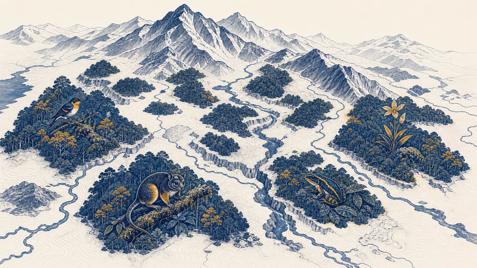
A biodiversity hotspot is a biogeographic region that concentrates exceptional numbers of unique plant species in severely reduced habitat, in the context of conservation geography. The biodiversity hotspot definition combines two ideas people often search separately: high endemism and high threat. A region qualifies only if it contains at least 1,500 endemic vascular plant species and retains no more than 30 percent of its original natural vegetation. The idea exists to help conservation planners decide where limited time and money can prevent many global extinctions.
A hotspot is therefore not simply a place with many living things. It is a large, biologically distinctive region where much of the original habitat has already disappeared. Madagascar and the Indian Ocean Islands, the Tropical Andes, and the forests of the Cape Floristic Region are examples. Each contains species with small global ranges, so damage in one place can remove an entire species from Earth.
What a biodiversity hotspot actually is
A biodiversity hotspot is a land region that passes fixed tests for biological irreplaceability and habitat loss. Its endemic plants occur nowhere else naturally, while the small amount of remaining native vegetation shows that those species face intense pressure.
The term has a narrower meaning than everyday phrases such as “wildlife hotspot.” A travel company might use that phrase for a wetland where visitors can see many birds. The scientific conservation concept covers broad biogeographic regions and uses thresholds. Conservation International applies the definition developed from the work of ecologist Norman Myers and later researchers.
Endemic means native to, and naturally restricted to, a stated area. A plant growing in many countries is native in each of them but is not endemic to any one of them. A plant found naturally only on one island is endemic to that island. The boundary matters because endemism always refers to a geographic range.
Vascular plants are plants with internal tissues that transport water and dissolved materials. Ferns, conifers, and flowering plants are vascular. Mosses are not. Plants are used because they are relatively well documented, form the physical structure of land habitats, and cannot leave as conditions change. They act as a consistent indicator, but the label does not claim that plants perfectly represent every animal, fungus, or microorganism.
Both tests matter. High endemism supplies the irreplaceability test. Severe vegetation loss supplies the threat test. Passing only one does not make a region a biodiversity hotspot under this definition.
The current global framework recognizes 36 hotspots. Conservation International reports that their surviving natural habitats occupy about 2.5 percent of Earth’s land surface, yet the regions contain more than half of the world’s plant species as endemics and nearly 43 percent of bird, mammal, reptile, and amphibian species as endemics. Those figures describe the hotspots collectively, not every patch within them.
How the two hotspot criteria work
The criteria work as a double filter: researchers count endemic vascular plants to measure irreplaceability, then compare remaining natural vegetation with its original extent to measure threat. A region receives the label only when it passes both filters at the same time.
Researchers group connected areas with related climate, vegetation, evolutionary history, and species. The result may cross national borders because organisms do not follow political lines.
Herbarium specimens, field surveys, taxonomic descriptions, and range maps show which vascular plant species occur there and which occur nowhere else naturally.
The inventory must contain at least 1,500 endemic vascular plant species. Introduced garden plants and species with wider natural ranges do not add to this total.
Scientists use vegetation records, soils, climate, historical maps, satellite evidence, and surviving fragments to estimate the natural cover before extensive human conversion.
If intact or meaningfully natural vegetation covers no more than 30 percent of the original area, the threat threshold is met. Both results are then reviewed together.
The vegetation calculation is a proportion, so a large region and a small region can be compared on the same scale.
If a region originally had 80,000 km² of natural vegetation and 20,000 km² remains, . It passes the habitat-loss test.
A region at 25 percent remaining has lost 75 percent. The two ways of stating the result describe the same change. This is easy to mishandle because “30 percent remaining” and “30 percent lost” sound similar but point to very different conditions.
The calculation looks exact, but its inputs require judgment. A lightly used native grassland may still count as natural habitat, while a tree plantation may look green in a satellite image yet lack the native community. Researchers must state what counts, which date represents the baseline, and how coarse the map is.
How a hotspot map is built
A hotspot map combines species records, habitat maps, and biogeographic boundaries. Scientists clean location data, estimate species ranges, identify endemic plants, reconstruct former vegetation, and test the two thresholds before drawing a broad region rather than isolated protected sites.
The raw evidence begins as points and observations. A pressed plant in a herbarium may carry a place, date, collector, and identification. A field team may record a population with geographic coordinates. Taxonomists check whether two differently named specimens are actually one species, or whether one supposed species is several. These decisions change the endemic count.
Geographic information systems let analysts place those layers over one another. Remote sensing helps distinguish forest, cropland, settlement, water, and other cover. Elevation models separate lowlands from mountain belts. Climate and geology help explain why neighboring areas support different plants. A final boundary simplifies fuzzy biological transitions into a usable planning unit.
Scale affects the result. A broad satellite pixel can hide a narrow strip of streamside forest. A national species database can stop at a border even when the habitat continues. A plant recorded only beside a road may seem rare because the rest of the range has not been surveyed. Good mapping therefore stores uncertainty instead of treating every line as a natural wall.
The map is also historical. It compares current remnants with a reconstructed former distribution, so it records change through time as well as location. This is one reason hotspots belong in geography: the concept joins spatial pattern, environmental process, and human land use on the same map.
Biodiversity hotspots versus species-rich places and protected areas
A hotspot is a threatened region rich in endemic plants, a species-rich place has many species without necessarily having narrow-range species, and a protected area is land or water governed for conservation. These categories can overlap, but none automatically implies the others.
The place with the most species must be the highest conservation priority, and calling it a hotspot means it is already protected.
Hotspot status depends on endemic plants plus habitat loss. The label covers a broad region and creates no law, reserve, owner, or management budget by itself.
Imagine two forests. Forest A has 900 plant species, with 400 found nowhere else. Forest B has 1,200 plant species, but nearly all also occur across a large neighboring region. Forest B is richer by total count. Forest A contributes more unique species to global biodiversity. If Forest A disappears, its 400 endemics have no natural population elsewhere.
A protected area answers a different question: who manages this place, under what rules, and for which purposes? A hotspot can contain national parks, farms, mines, towns, Indigenous territories, reservoirs, and roads. Some habitat fragments may have strict legal protection. Others may remain because steep slopes are hard to cultivate, not because any law protects them.
The hotspot concept also differs from a Key Biodiversity Area. A hotspot is a very large regional priority based on its overall endemism and habitat loss. A Key Biodiversity Area is a site identified for its measurable contribution to the persistence of biodiversity. Site-scale planning inside a hotspot may use the second framework to locate action.
How geography creates endemism and risk
Geography creates endemism when barriers, isolation, and varied environments restrict movement and allow populations to evolve separately. The same restricted ranges create risk because habitat conversion, fire, disease, or climate shifts can affect a large share of a species at once.
Mountains split populations between valleys and elevation zones. Islands limit immigration and escape. Dry basins can isolate moist forests like biological islands. Different rocks produce different soils, which favor plants adapted to particular nutrients or toxic minerals. Over many generations, separated populations accumulate differences. Some become distinct species whose entire range fits inside one ridge, island, or soil belt.
The Tropical Andes illustrate the mechanism. Steep elevation changes produce rapid shifts in temperature and moisture over short horizontal distances. Valleys and peaks separate populations, while varied slopes create many local habitats. A road, farm frontier, or warming climate can then squeeze a mountain species because moving uphill eventually leaves no higher ground.
Islands make the range problem even clearer. A plant that evolved on one island may not tolerate the climate of another. It may depend on a local pollinator or soil. Clearing its last forest is not a local reduction of a widespread species. It is a global extinction risk.
A proposed quarry overlaps half of the known habitat of a plant restricted to limestone near a single ridge. A countrywide forest map may show little change, yet a species-range map shows a major global loss. Planners need both scales before deciding where extraction can occur.
Human geography supplies the other half of the pattern. Productive volcanic soils attract farming. Mild coastal climates attract cities and transport routes. Forest edges become accessible after roads arrive. Global demand can raise the value of timber, minerals, crops, or housing. For a clear account of one major land-cover process, see how deforestation changes places and systems.
Climate change adds a moving pressure. Species ranges may shift poleward or uphill as temperature and rainfall patterns change, but farms, walls, roads, and cleared valleys can block movement between remnants. Protecting one patch without a connected route may preserve current habitat while preventing later adjustment.
How hotspots show up in conservation decisions
Hotspots show up in conservation as a first-pass priority map for directing research, funding, restoration, and policy toward regions where many unique species face habitat loss. The regional label guides attention, while local evidence determines the exact site and action.
A funder comparing work across continents can use the hotspot layer to identify regions with high potential to prevent extinctions. Within one hotspot, planners then ask finer questions. Which remaining fragments hold the narrowest-range species? Which river corridor connects two forests? Which community has secure rights and wants restoration? Which threat is immediate enough to require action now?
The answer is rarely “fence off everything.” Conservation can include protected areas, community-managed forests, habitat corridors, farm practices that retain native vegetation, control of invasive species, safer road routes, fire management, and restoration. The appropriate mix depends on ecology, land rights, livelihoods, enforcement, and cost. The page on how conservation protects species and habitats explains those tools at the site and policy scales.
His paper in The Environmentalist identified ten tropical forest areas with exceptional endemism and rapid habitat depletion.
Myers and colleagues set out the plant-endemism and habitat-loss thresholds in a paper in Nature, making comparison more systematic.
Conservation organizations use the hotspot map as one layer among species, ecosystem, social, legal, and cost information.
Priority setting always has an opportunity cost. Money spent in one location cannot be spent twice. Hotspots make one value explicit: preventing the disappearance of species with nowhere else to survive. They do not automatically rank carbon storage, freshwater supply, cultural value, animal migration, or human need. Decision-makers must add those layers rather than pretending one map answers every question.
How hotspots show up in work, law, money, and daily decisions
Hotspots affect practical choices made by ecologists, map analysts, planners, lawyers, lenders, farmers, and residents. They influence where surveys happen, how projects assess environmental risk, which restoration proposals receive money, and what evidence communities use in land decisions.
Field biology turns records into range evidence
Botanists collect specimens, compare plant features, and record precise locations. Ecologists measure habitat condition and search for pollinators, seed dispersers, or invasive competitors. Taxonomists may discover that a “widespread” plant is several distinct species, leaving one newly recognized species with a tiny range. That finding changes risk even though the plants themselves have not moved.
Geospatial work reveals overlap and fragmentation
GIS analysts combine satellite images, land parcels, elevation, roads, fires, proposed developments, and species observations. Their maps can show that two large forest blocks are joined by one narrow corridor. They also check resolution and dates, since an old land-cover layer can miss recent clearing and a coarse layer can merge separate fragments.
Planning and law turn evidence into conditions
An environmental impact assessment may require a developer to survey endemic species before a permit decision. Officials can reroute a road, reduce a project footprint, set seasonal work limits, require restoration, or reject a site where impacts cannot be made acceptable. Hotspot status is relevant context, but the binding force comes from national law, permit terms, protected-area rules, land rights, and court decisions.
Finance changes what happens on the ground
Public agencies, charities, development banks, and private lenders may screen projects for biodiversity risk. A lender can ask whether a plantation would replace natural habitat or use already converted land. A conservation fund can compare the cost of securing a corridor with the number and vulnerability of species helped. Good accounting includes long-term management, not only the price of planting trees.
A food company learns that a proposed supplier would clear native vegetation inside a hotspot. The regional label signals high risk, but it does not settle the case. The company still needs a recent habitat map, legal land records, field surveys, and traceable sourcing before choosing another site or supplier.
Daily decisions connect indirectly. Food, timber, metals, tourism, housing, and energy all have land footprints. Labels and sourcing records can help, but vague claims such as “green” reveal little. A useful question is specific: did this product cause conversion of natural habitat, and can its origin be traced? Related impacts from chemicals, plastics, and waste are covered in the geography of pollution sources and effects.
Four mistakes people make with biodiversity hotspots
Most errors come from treating the word “hotspot” as a general compliment or a complete decision rule. The formal concept has two thresholds, a regional scale, and a limited purpose. Reading more into it produces weak maps and poor choices.
1. Calling every species-rich place a hotspot
A coral reef, urban wetland, or seasonal bird gathering may contain many species and deserve protection. It is not automatically one of the formally recognized terrestrial biodiversity hotspots. The defining count concerns endemic vascular plants, and the defining threat concerns loss of original natural vegetation across a biogeographic region.
2. Treating every location inside the boundary as equally valuable
A hotspot boundary can enclose a city center, an industrial field, a reservoir, a rich remnant forest, and a breeding site for a narrow-range animal. Their present ecological roles differ sharply. Regional status starts an inquiry. It does not replace site surveys or make every hectare interchangeable.
3. Assuming the label creates legal protection
A global classification is not a zoning order. Landowners and governments do not acquire identical duties simply because a line appears on an international map. Legal consequences depend on the jurisdiction and the site. The label can influence evidence, funding, and public debate without itself banning development.
4. Using hotspots as the only conservation map
Some large wilderness areas retain most of their original vegetation and therefore fail the loss test, even though early action could keep them intact. Other places are important for migratory routes, carbon-rich peat, freshwater, or a single threatened species without meeting the hotspot criteria. A sound plan compares several layers and states which values it is prioritizing.
Absence from the hotspot map does not mean safe or expendable. It means only that the region does not pass this particular combination of plant endemism and historical habitat loss.
The reverse warning matters too. Presence on the map does not prove that a proposed action is harmful. A rooftop solar project in an existing city and the clearance of a native forest can both sit inside the same broad hotspot. Their footprints and effects require separate assessment.
Can people live and work inside a hotspot?
People can and do live, farm, build businesses, and govern cities inside biodiversity hotspots. The designation is not a plan to remove residents. It identifies a regional conservation problem that must be addressed through land-use choices, rights, livelihoods, and local knowledge.
Many hotspot landscapes have been shaped by people for generations. Indigenous peoples and local communities may manage forests, grasslands, fires, or water in ways that sustain habitat. Others may face insecure tenure or pressure from outside investors. Treating all residents as one threat hides who makes decisions, who receives benefits, and who bears restrictions.
Coexistence is easier when development uses already converted land, retains native corridors, protects streams, limits invasive species, and rewards long-term stewardship. It becomes harder when roads open intact fragments to uncontrolled clearing or when conservation rules ignore legitimate rights. Human geography helps trace those different powers and consequences.
Can a damaged hotspot recover?
A damaged hotspot can recover some habitat structure and ecological function, but restoration cannot guarantee the return of extinct species, lost soils, or old relationships. Protecting good remnants usually prevents more loss, while restoration expands and reconnects what survives.
Recovery depends on the damage. A recently cleared field beside native forest may receive seeds and animals naturally. A mined site may need soil reconstruction. An island invaded by rats may need sustained control before ground-nesting birds can breed safely. A warming mountain may require connected elevation corridors rather than planting one fixed patch.
Restoration targets should name the desired result. “Plant trees” is too vague. Native species composition, canopy cover, stream shade, pollinator use, seedling survival, and corridor width answer different questions. A plantation of one fast-growing species can raise tree cover while failing to recreate the original ecosystem.
Monitoring completes the work. Teams compare restored and reference sites, record survival and reproduction, and adjust management. If seedlings die because grazing continues, more planting will repeat the failure. If a corridor is too narrow for a target animal, the design must change. Restoration is an observed process, not a promise attached to a planting day.
Biodiversity hotspots turn geography into choices
Biodiversity hotspots show how physical geography, biological history, and human land use combine in particular places. The concept turns distributions and habitat change into a testable priority, while reminding planners that a global map must be checked against local evidence.
The central chain is simple: geographic isolation helps species become unique, concentrated land conversion removes their habitat, and small ranges make local damage globally significant. Maps reveal the overlap. Institutions then decide what to protect, restore, permit, finance, or monitor.
The takeaway: A true biodiversity hotspot is both irreplaceable and highly threatened. Look for the endemic-plant count, the percentage of original vegetation remaining, and the scale of the map before accepting the label.
The next time a news report, company, or campaign calls a place a biodiversity hotspot, check what the term means there. Ask which species are endemic, how habitat loss was measured, who drew the boundary, and what action follows. Those questions connect the idea to how environmental patterns and human decisions fit into geography, and they separate a useful spatial tool from a vague claim.