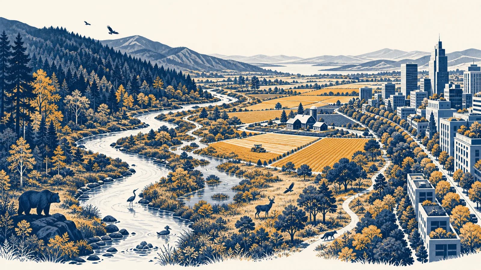
Conservation is a system of managing species, habitats, water, soil and other natural resources so they can persist and function, in the context of environmental geography. In simple terms, conservation protects nature while deciding how people may use it. It exists because land, wildlife and resources can be damaged or exhausted faster than natural processes replace them. Conservation geography asks where pressures occur, who causes them, who benefits from protection, and how action in one place affects another. It includes protected areas, habitat restoration, sustainable use, wildlife management and rules that limit harmful activity.
What conservation actually is
Conservation is planned action that maintains biological diversity, ecological processes and useful natural resources over time. It combines scientific evidence with laws, money and local decisions because protecting a place requires both knowledge of how it works and agreement about how people will use it.
The word covers several related tasks. A conservation project might stop a species from being killed, reconnect pieces of forest, restore a wetland, change how timber is harvested, or remove a pollutant from a river. The shared aim is persistence. The species, habitat or resource should still be able to function after the immediate project ends.
Environmental geographers study conservation spatially. They map where organisms live, where threats are concentrated, how rivers and migration routes connect places, and how costs and benefits are distributed. A fence drawn around a reserve is not the same as a working conservation system. Water may enter from farms upstream. Animals may leave the boundary in one season. Residents may rely on the enclosed land for fuel, grazing or food.
Conservation means keeping people out of untouched nature.
Conservation can use strict protection, regulated harvesting, restoration, incentives and community management. The appropriate method depends on the place and the cause of loss.
Conservation is therefore both ecological and political. Ecologists can estimate what a population needs, but people decide which uses are legal, whose evidence counts and who pays. Sustainability overlaps with conservation but covers social and economic systems more broadly, including how present choices affect future needs.
How conservation works
Conservation works by defining a valued feature, measuring its condition, identifying the processes that threaten it, choosing actions aimed at those causes, and monitoring the result. Managers then keep, change or stop the actions according to evidence rather than assuming that protection automatically succeeds.
Name what should persist and at what scale. A target might be a breeding population, a whole salt marsh, clean water in a catchment, or a corridor between two forests.
Record the current area, distribution, population structure or ecological condition. Without a baseline, later change cannot be separated from impression or memory.
Trace the chain of cause. Falling bird numbers might come from nest loss, fewer insects, introduced predators, hunting, or several pressures acting together.
Act on the cause. Restore nesting sites if habitat is limiting, change fishing gear if accidental capture is the problem, or control an invasive predator if it drives breeding failure.
Measure the same indicators again. Compare results with the objective, account for other changes, and revise the intervention if the response is weak or harmful.
This cycle is called adaptive management. It treats a policy as a testable choice. Suppose a wetland manager wants more successful nesting by a ground-nesting bird. The manager records nests and fledglings, restricts access during the breeding season, and repeats the count. If nests increase but fledglings do not, trampling was probably not the only limiting pressure. Predator control, water level or food supply may require investigation.
Good indicators are closely tied to the objective. Counting visitors tells a park how much recreation occurs, but not whether a rare plant survives. Total forest area can hide replacement of old, diverse woodland with a young single-species plantation. Managers often need several measures, such as habitat area, connectivity, breeding success and water quality, to detect meaningful change.
How populations and habitats set the limits
Species persist only if births and arrivals can offset deaths and departures, while habitats persist only if ecological processes keep renewing them. Conservation therefore manages rates, areas and connections, not just individual organisms or isolated scenic sites.
Population change is a balance
A local population changes through four flows. Births and immigration add individuals. Deaths and emigration remove them. The accounting relation is simple, even though measuring every term is difficult.
If a population begins with 240 animals, records 36 births, 12 immigrants, 30 deaths and 18 emigrants, the change is zero: . The final population is 240.
A stable total does not prove that a population is safe. If most breeding adults are old, future births may fall. If immigrants continually replace local deaths, the site may be a sink that cannot support itself. Conservationists therefore examine age structure, sex ratio, genetic diversity and movement, alongside the head count.
Habitat quality and habitat amount are different
Ten square kilometres of suitable breeding habitat may support more wildlife than a larger area lacking food, shelter or water. Quality also changes through time. A grassland may need grazing, cutting or fire at suitable intervals to stop shrubs taking over. Preventing every disturbance can alter the habitat that protection was meant to keep.
Boundary does not equal habitat. A protected-area map shows legal control. It does not prove that the enclosed land has the food, water, breeding sites or connections required by its species.
Connectivity matters when organisms must move between feeding, breeding and seasonal habitats. A road, dam or cleared field can split one population into small groups. Corridors, wildlife crossings and restored river channels can reconnect them, but their design must match the organism. A narrow strip useful to insects may not meet the needs of a large mammal.
Conservation versus preservation
Conservation manages nature to maintain it over time and may permit controlled human use, while preservation generally seeks to keep a place or feature free from use or alteration. In practice, one landscape can contain both approaches in different zones.
A forest managed for conservation might allow selective timber cutting below a set rate, protect nesting trees and leave streamside vegetation intact. A preserved part of the same forest might prohibit extraction because it contains a highly sensitive habitat. The distinction concerns the kind and degree of human use, not whether people care about nature.
Another nearby term is restoration. Restoration is an action that assists recovery after damage, such as blocking drains in a peatland or replanting native vegetation beside a river. Conservation is the larger continuing aim. Restoration can serve that aim, but restored land still needs protection from the pressure that damaged it.
A water company may conserve the catchment by paying farmers to reduce soil loss and restore bog vegetation. It may preserve a small erosion-prone zone by excluding grazing entirely. It may restore blocked stream banks. The three methods answer different parts of one water problem.
Conservation also differs from animal welfare. Welfare concerns the condition and suffering of individual animals. Conservation usually concerns populations, species and ecosystems. Removing an introduced predator can protect a threatened prey population while raising serious welfare questions about the animals removed. A responsible plan must recognize both concerns without pretending they are identical.
How protected areas work in connected landscapes
Protected areas work by restricting damaging activities within a defined place, but their success depends on location, enforcement, ecological design and links to surrounding land. A reserve that ignores migration, water flow or local livelihoods may be protected on paper yet ineffective on the ground.
Location is the first decision. Protecting land simply because it is remote or cheap may leave the most threatened habitats outside. Planners compare maps of species, habitats, development pressure, land ownership and existing protection. They also look for complementarity: a new site should protect features missing from the current network rather than repeat only what is already well covered.
Size, shape and edges change ecological conditions
A compact reserve usually contains more interior habitat per unit of area than a long, thin reserve. At an edge, light, wind, noise, predators and human access may differ from conditions inside. These edge effects can reach into the protected habitat. A narrow woodland strip may therefore have little true interior even if its mapped area seems substantial.
A simple geometric example shows why. A square reserve measuring 2 kilometres on each side has an area of 4 square kilometres and a perimeter of 8 kilometres. A rectangle 4 kilometres long and 1 kilometre wide has the same area but a perimeter of 10 kilometres. The longer boundary exposes more land to outside influences.
Shape is not the only consideration. A long reserve following a river may protect more useful habitat than a compact patch placed elsewhere. Marine reserves must account for currents and the movement of larvae, fish and fishing boats. Mountain reserves may need an elevation range so species can shift as temperature and rainfall patterns change.
Rules need legitimacy and enforcement
A legal boundary changes little if destructive activity remains profitable and enforcement is absent. Rangers, courts and monitoring can impose rules, while permits and zoning can allow compatible use. Long-term compliance is more likely when local people understand the objective, can influence decisions, and receive a fair share of benefits or compensation.
Conservation outside reserves is equally important. Farms, towns, managed forests and transport corridors sit between protected sites. Hedgerows, fish passages, shade trees and reduced pesticide use can make those working landscapes more permeable to wildlife. The geography of forest loss and its connected causes shows why a reserve cannot be separated from roads, markets and settlement around it.
How conservation priorities are chosen
Conservation priorities are choices about where limited time, land and money can prevent the greatest loss or produce the greatest recovery. Decision makers compare biological value, threat, feasibility, cost, social effects and uncertainty rather than relying on a single universal ranking.
Urgency matters. A small population facing immediate habitat destruction may need action before a widespread species declining slowly. Uniqueness matters too. Losing a species found in only one valley is different from losing one local population of a species that remains common elsewhere. Ecological function may add another reason for priority if a species pollinates plants, creates habitat or strongly affects food webs.
Feasibility prevents plans from becoming wish lists. A threatened wetland may be recoverable by changing a sluice gate, while another has been built over and cannot be recreated in the same place. Cost includes purchase and construction, but also staffing, monitoring, compensation and future maintenance. A cheap intervention that fails repeatedly is not economical.
This can favour species-rich places, even if many species are secure elsewhere.
This can direct action toward threatened and irreplaceable features, while requiring harder judgments about urgency, cost and success.
Opportunity cost is the benefit given up by choosing one option. If a conservation budget buys an expensive parcel of land, it cannot also fund several river restorations. This does not mean the parcel is a bad choice. It means its expected benefit should be compared with realistic alternatives.
Priorities are also ethical choices. Protecting wildlife may restrict farming, fishing or housing. Those costs do not fall evenly. A plan should identify who gives up access, who gains cleaner water or tourism income, and who has decision-making power. Consultation cannot guarantee agreement, but it can reveal knowledge and impacts missing from a remote assessment.
Maps can make priorities legible, but every map leaves something out. A habitat map may be several years old, seasonal use may be invisible, and a sharp boundary may hide uncertainty. Field surveys and local observations test what mapped categories mean on the ground.
How conservation shows up in farms, cities and coasts
Conservation appears in everyday landscapes through rules and designs that retain habitat, reduce pressure and keep ecological processes working. It is present in farming methods, urban planning, water management, fisheries, road design and purchasing decisions, not only in distant reserves.
Farms manage production and habitat together
A farm can conserve soil by keeping it covered, reducing repeated disturbance and slowing runoff. Field margins, ponds and hedgerows can provide feeding and nesting habitat. Fertilizer timing matters because nutrients applied before heavy rain may wash into streams instead of reaching crops. These choices affect production as well as downstream ecosystems.
Landscape arrangement changes the result. Ten isolated flower strips may support fewer movements than strips connected along field edges, depending on the species. Conservation advice therefore needs maps of fields, watercourses and neighbouring land, not only a list of practices for each farm.
Cities contain habitat and environmental pressures
Urban conservation protects remnant habitats, street trees, rivers, gardens and routes between them. A tree planting scheme succeeds only if chosen species fit the soil and street, young trees receive water, and roots have room to grow. Planting totals measure activity. Tree survival and canopy development measure results.
Parks can be managed with varied vegetation heights, dead wood and less frequent mowing in selected areas. Building design can retain nesting spaces. Lighting can be aimed and timed to reduce disturbance. These measures must coexist with safety, access, housing and recreation. Studying how built surfaces create urban heat also shows where tree cover and water can serve people and ecosystems at the same time.
A developer proposes housing beside a stream. A conservation assessment maps floodplain vegetation, breeding sites and animal movement. The design keeps a vegetated buffer, places crossings away from sensitive areas, controls construction runoff and funds monitoring. Approval conditions specify what must be measured and what happens if the measures fail.
Coasts require moving boundaries
Salt marshes, dunes and mangroves change position as sediment moves and water levels vary. A fixed sea wall can squeeze coastal habitat between rising water and development. Allowing water onto selected land, moving infrastructure, or setting development back can give habitat space to shift. The social question is which land changes use and how affected owners or residents are treated.
Fishing conservation manages both harvest and habitat. Tools include seasonal closures during breeding, size limits, gear that reduces accidental catch, and areas closed to extraction. A rule must match the species' life cycle and movement. Enforcement at landing sites and through supply chains may be as important as patrols on the water.
How success and failure are measured
Conservation succeeds when evidence shows that the intended ecological condition improved because of the intervention and can persist. Reliable evaluation compares indicators through time, uses a relevant comparison where possible, and checks social costs and unintended effects alongside biological results.
The first distinction is between inputs, outputs and outcomes. Money and staff time are inputs. Kilometres of fence or hectares planted are outputs. Increased breeding success, cleaner water or natural vegetation recovery are outcomes. Outputs are easier to count, but they do not establish that the target benefited.
Attribution asks what would have happened without the action. If bird numbers rise after restoration, the project may deserve credit, but mild weather or a regional population increase might also explain the change. Monitoring a similar untreated site can help. Measurements before and after action at both sites provide a stronger comparison than a single count after completion.
Time scale can mislead. Vegetation may establish quickly, while mature woodland structure develops slowly. Fish may return soon after a barrier is removed, but genetic exchange takes generations to detect. A monitoring period should match the response being claimed.
A worked survival rate does not tell the whole story
Suppose 80 planted trees are alive after one year and 60 remain after five years. The five-year survival proportion is , or 75 percent. That calculation is checkable, but success still depends on the objective. The surviving trees may be healthy and well placed, or crowded and unable to develop a canopy.
Social monitoring asks if people lost income, access or safety, and whether promised benefits arrived. A conservation outcome that depends on unpaid burdens or unresolved conflict may not persist. Interviews, access records and livelihood measures can sit beside species surveys, provided the project states clearly what each indicator represents.
4 mistakes people make with conservation
Common conservation mistakes are protecting a boundary instead of a functioning system, acting on symptoms instead of causes, treating planting as automatic restoration, and excluding affected people from decisions. Each error confuses a visible activity with the long-term ecological and social result.
1. Assuming a protected label guarantees protection
A declaration creates legal status, not automatic compliance or ecological health. Effective protection needs a suitable boundary, clear rules, staff, finance, monitoring and a response to outside pressures. A river reserve can still receive polluted water from upstream, and migratory wildlife can still be harmed elsewhere.
2. Treating the symptom instead of the cause
Releasing captive-bred animals may raise numbers briefly, but it will not solve habitat loss or continued killing. Cleaning litter from a beach improves the site, but repeated waste inputs require action farther up the chain. The causes and movement of contaminants are examined more fully through how pollution travels and accumulates.
An intervention can move a problem. Banning extraction in one site may shift it to an unprotected site. Evaluation must look beyond the project boundary for leakage.
3. Counting planted organisms as restored habitat
Planting is an action. Restoration requires establishment, survival and the return of ecological functions. The wrong species can fail in local soil, use too much water or create a uniform stand with little habitat variety. Natural regeneration may work better where seeds, soil and disturbance conditions remain suitable.
4. Treating local people as one interest group
A village, neighbourhood or industry contains people with different rights, incomes and dependence on resources. A meeting attended by a few leaders does not reveal every effect. Managers should identify users directly, including seasonal workers and groups with less formal power, then track how restrictions and benefits are distributed.
These mistakes share a pattern: they replace a difficult outcome with an easy proxy. Boundaries, releases, seedlings and meetings can all be useful. None proves on its own that species persist, habitats function or agreements remain fair.
What ex situ conservation actually is
Ex situ conservation keeps threatened genetic material or organisms outside their natural habitat in seed banks, tissue collections, botanical gardens, aquariums or breeding programmes. It is a backup and management tool, not a full substitute for conserving functioning habitats in place.
Stored seeds can preserve genetic variation and provide material for research or later reintroduction. Some species produce seeds that do not tolerate normal drying and freezing, so living collections or other techniques are needed. Captive breeding can increase numbers, but small populations may lose genetic diversity and animals may lose behaviours needed in the wild.
Reintroduction works only if the original threat has been removed or reduced. Released organisms need suitable habitat, enough genetic variation, appropriate behaviour and monitoring. If a wetland was drained, breeding more wetland animals does not restore the water regime they require.
How individual choices connect to conservation
Individual choices affect conservation through demand, land management, political support and direct disturbance, but their influence depends on wider systems. A careful purchase or wildlife-friendly garden helps most when rules, producers and public investment also change the conditions that shape many choices at once.
Useful actions are specific to the pressure. Keeping dogs controlled near ground-nesting birds can reduce disturbance. Cleaning boots between water bodies can reduce the movement of invasive organisms. Buying a certified product may support agreed production standards, although a label should be checked for its criteria, auditing and chain of custody.
Citizens also meet conservation through planning notices, water bills, park rules, fishing permits and elections. Reading the stated objective makes public choices easier to judge. Does a proposed scheme name the habitat or population it will protect? Does it measure an outcome? Is long-term maintenance funded? What happens if monitoring shows failure?
At a local pond: record the same indicator at the same season each year, such as the number of occupied amphibian egg masses. A repeatable observation is more useful than a general claim that the pond looks healthier.
People should avoid moving organisms casually. Releasing garden plants, aquarium animals or unwanted pets can introduce predators, competitors or disease. Even well-meant wildlife feeding can concentrate animals and alter behaviour. Local guidance matters because effects differ among species and places.
Conservation makes geography visible in every decision
Conservation shows that environmental outcomes depend on location, scale, connection and power. It turns maps into decisions about habitats and resources, then tests those decisions against evidence. The next useful move is to trace one local pressure from its source to its effects.
Choose a nearby river, park, coast, woodland or vacant lot. Mark what is being conserved, the boundary used for management, the processes that cross it, and the people who use the place. Then ask what indicator would show improvement and what comparison would make that change convincing.
The takeaway: conservation is not a promise to keep nature unchanged. It is a continuing, evidence-based process for keeping species, habitats and resources able to function while people make choices about land and use.
This way of thinking connects conservation to the wider study of places, environments and human choices. Notice the next conservation claim you encounter in news, law or advertising. Look for its target, scale, cause, action and measure of success. If one is missing, the claim is incomplete.