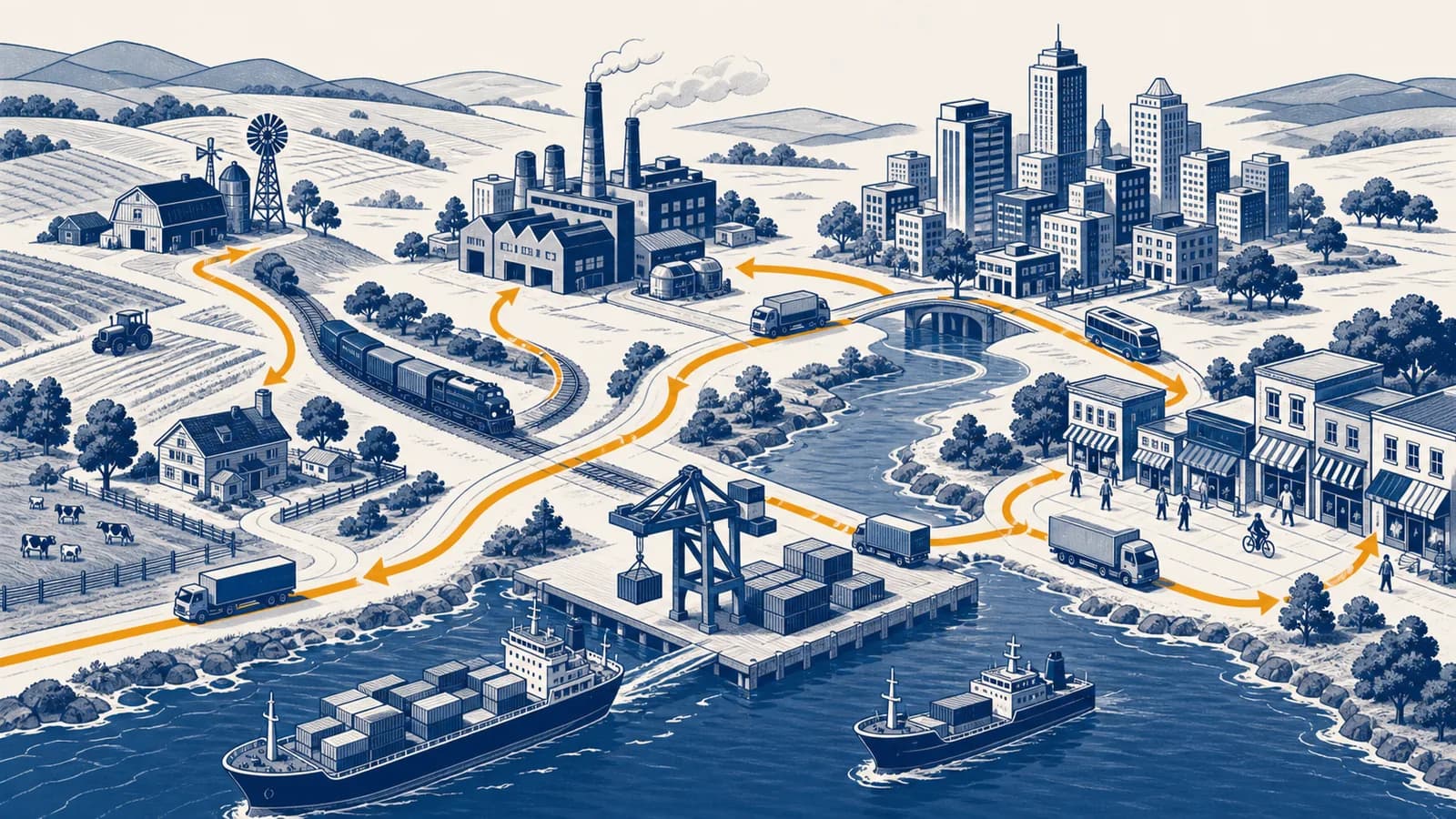
Economic geography is a branch of human geography that explains where economic activities happen, why they concentrate or spread, and how places are connected through production, trade, work, and consumption. It studies the location of industries, farming, services, jobs, resources, transport, markets, and global supply chains. The idea exists because distance, land, labor, infrastructure, and political borders shape what can be produced, what it costs, and who benefits. Economic geographers ask why a port attracts warehouses, why a technology cluster forms in one city, and why the price of the same product differs between places.
What economic geography actually is
Economic geography is the study of the spatial organization of economies: the locations of workers, firms, resources, and consumers, plus the flows that connect them. It explains economic patterns by treating location and distance as active causes, not as background details.
An economy has a geography because production always happens somewhere. A field needs suitable soil and climate. A factory needs land, electricity, workers, inputs, and routes to customers. A hospital needs trained staff and enough patients within reach. Even a digital service depends on offices, homes, data centers, cables, power grids, and laws that apply in particular territories.
The subject studies location, which means where an activity is placed; distribution, which means the pattern made by many locations; and flows, which are movements between places. Goods move in trucks and ships. Money moves through payment systems. People commute or migrate. Information moves through communications networks. Each movement has a cost, a speed, a capacity, and sometimes a legal barrier.
Scale changes the question. At a neighborhood scale, a geographer might examine why grocery stores cluster on a busy road. At a national scale, the topic could be the concentration of high wage jobs in a few metropolitan regions. At a global scale, it could be the chain linking a mine, a component factory, an assembly plant, a port, and a final customer.
Location changes value. A tonne of stone beside a construction site and the same tonne on the far side of an ocean are physically identical, but their usable value differs because transport takes money and time.
How location decisions work
A location decision compares the advantages and costs of possible sites. Firms and households weigh access to inputs, workers, customers, land, infrastructure, information, and public services, then choose under uncertainty and within legal, financial, and personal limits.
No site is best for every activity. A bakery benefits from passing customers, while an airport needs large areas of land and safe approach paths. A call center may value language skills and reliable internet more than access to heavy freight. A steel plant must move bulky raw materials and finished products, so rail, water transport, energy supply, and industrial land carry unusual weight.
Identify what must enter the operation, what leaves it, and which people need access. A warehouse and a design studio have different requirements.
Compare land, labor, utilities, transport, taxes, regulations, suppliers, customers, hazards, and room to expand.
Include rent and wages, but also freight, delays, inventory, insurance, staff recruitment, compliance, and the risk of disruption.
A site near specialist suppliers, experienced workers, or research institutions may create benefits that a simple rent comparison misses.
The decision changes the place itself. New jobs, traffic, skills, and demand can alter later decisions by other firms and households.
A simple worked comparison shows why the cheapest building may not produce the lowest operating cost. Suppose Site A costs 120 units per week in rent and requires 80 units of delivery costs. Site B costs 160 units in rent but only 25 units for deliveries. If all other costs are equal, Site A costs 200 units while Site B costs 185. The more expensive building is the cheaper location.
For Site B: 160 units of rent plus 25 units of deliveries gives 185 units before the other shared costs are added.
Real decisions also depend on imperfect information. Managers may copy competitors, stay near a founder's home, or avoid an unfamiliar region. Governments can change the calculation with zoning, roads, training, grants, tariffs, or environmental rules. Location is therefore an economic choice shaped by institutions and habits as well as arithmetic.
How distance, transport, and access shape cost
Distance affects economic activity through transport expense, travel time, reliability, and the difficulty of exchanging knowledge. Better access reduces some forms of friction, but congestion, border checks, missed connections, and weak infrastructure can make a short route costly.
Geographers often think in terms of friction of distance. Interaction generally becomes harder as distance increases because moving people, goods, or information consumes resources. The effect differs by product. Sending a design file is cheap and fast once a connection exists. Moving fresh milk requires vehicles, refrigeration, scheduled collection, and quick delivery. Moving a surgeon requires the surgeon's time.
Distance can be measured in kilometers, but economic distance is often more useful. Two businesses 100 kilometers apart on a reliable motorway may exchange goods more easily than businesses 30 kilometers apart across a mountain or congested border. Time, price, predictability, frequency, and capacity all contribute to effective access.
Every arrow can change the final price. Freight charges are obvious, but time creates hidden costs. Goods held in transit cannot be sold. Unreliable arrivals force a business to keep spare inventory. A missed delivery can stop a production line. This is why how transportation networks connect places is central to explaining industrial locations and market reach.
Access also shapes daily life. A job that pays more may still be a poor option if the commute is long, unreliable, or expensive. A supermarket can offer low shelf prices yet remain inaccessible to a household without a car. Economic geography asks who can reach an opportunity, not only where the opportunity appears on a map.
How land, labor, capital, and resources fit together
Production combines land and natural resources, human labor and knowledge, tools and finance, plus organization. Their distributions rarely match, so firms connect places or move activities to bring the required inputs together at an acceptable cost.
Land means more than an empty plot. It includes location, area, terrain, water access, soil, mineral deposits, climate, and the permissions attached to a site. Central land often costs more because many users compete for access. Activities that earn high revenue from each square metre, such as offices or shops, can often bid more than storage yards or extensive farming.
Labor varies by number of workers, skills, experience, wages, language, working conditions, and legal rights. A region with low wages is not automatically a low cost location. Training, staff turnover, output per hour, management time, and quality errors all matter. Workers are people with households and social ties, so housing, schools, transport, and safety affect where a labor pool forms.
Capital includes physical equipment and the finance used to obtain it. It also includes long lived infrastructure such as power lines, ports, water systems, and broadband. Investment tends to favor places where future returns seem predictable. That can reinforce existing advantages, since places with strong infrastructure attract activity that supports further investment.
| Input | Spatial question | Example constraint |
|---|---|---|
| Land and resources | Where does the required site or material exist? | A mine must be placed at the deposit. |
| Labor and knowledge | Where can suitable workers live and work? | A laboratory needs specialist staff. |
| Capital and infrastructure | Where are finance, equipment, and networks available? | A cold store needs dependable electricity. |
| Market access | Where are buyers, and how can the product reach them? | A restaurant needs customers close enough to visit. |
Some resources fix the first stage of production in place. Ore must be extracted where geology put it, and crops grow under particular environmental conditions. Later stages can move. Raw material may be refined near the source, near cheap energy, near a port, or near buyers. The chosen arrangement depends on how weight, bulk, perishability, skill, regulation, and value change during production.
Agglomeration versus dispersion
Agglomeration is the concentration of related economic activity in one place, while dispersion is its spread across different places. Concentration creates shared advantages, but rising land costs, congestion, competition, risk, and digital or transport improvements can push activity outward.
Shared suppliers, specialist workers, large customer markets, infrastructure, face to face contact, and knowledge exchange make a cluster productive.
High rents, traffic, pollution, labor competition, regulation, disaster exposure, and the search for new customers encourage movement or decentralization.
A cluster can become self-reinforcing. One specialist employer attracts trained workers. Their presence makes the area more attractive to similar employers. Suppliers gain enough customers to locate nearby, while colleges offer relevant courses. Workers can change jobs without leaving the region, and firms can hire people who already know the industry. These are agglomeration economies, savings or productivity gains created by proximity.
Clustering does not mean every task stays together. A company may keep research near a university, place assembly near suppliers, use a distant customer service center, and store goods beside a motorway. It divides its value chain according to the needs of each function. Good analysis therefore maps activities within firms, not just the addresses of headquarters.
A growing furniture maker wants more space. Staying in the city preserves access to designers, customers, and skilled craftspeople, but rent and delivery congestion are high. Moving to the edge offers a larger workshop and easier truck access. The firm may split its functions, keeping a showroom and design team centrally while moving production and storage outward.
Dispersion can also follow demand. Clinics, repair shops, and food stores serve people in many settlements, so they cannot all concentrate in one national center. Other activities concentrate because they serve a large territory from one facility. The balance depends on the savings from scale compared with the cost of reaching users.
How regions specialize and trade
Regions specialize when their resources, skills, institutions, history, or market access make some activities relatively attractive. Trade then allows places to exchange outputs, although specialization also exposes workers and communities to changes in demand, technology, policy, and supply.
A useful starting idea is comparative advantage. A place can benefit from specializing in an activity with a lower opportunity cost, even if another place could perform every activity with fewer inputs. Opportunity cost means what must be given up to produce one more unit.
Consider two regions using one day of work. In that day, North can produce either 12 baskets or 6 chairs. One chair therefore costs North 2 baskets in forgone output. South can produce either 8 baskets or 8 chairs, so one chair costs South 1 basket. South has the lower opportunity cost in chairs, while North has the lower opportunity cost in baskets.
This model isolates one mechanism, but real trade includes transport costs, bargaining power, tariffs, standards, exchange rates, environmental effects, and unequal ownership. A region may export valuable goods while much of the profit goes to owners elsewhere. It may specialize because of past coercion or public policy, not because of a neutral market calculation.
Specialization also changes over time. Skills accumulate through practice, infrastructure is built around leading industries, and local institutions adapt. This creates path dependence: earlier decisions narrow or shape later options. A port city may retain logistics expertise after its original cargo changes. An old manufacturing region may have engineering skills that support new industries, but abandoned sites and mismatched qualifications can slow adjustment.
How supply chains connect local choices to global systems
A supply chain is the linked sequence through which materials, components, services, information, and finance become a product and reach a user. Economic geography explains why each stage occupies a particular place and how disruption in one node affects others.
Take a cotton shirt. Cotton must be grown, cleaned, spun into yarn, woven or knitted, dyed, cut, sewn, packed, transported, sold, used, and eventually reused, recycled, or discarded. These stages need different combinations of climate, water, machinery, labor, chemicals, skills, capital, and market access. They may occur in one country or across several.
The chain is also a network because a factory can have several suppliers and serve several markets. A visible brand may coordinate design and sales while contracting out production. Mapping ownership alongside material flows shows who sets standards, carries risk, and receives revenue. The geography of production is therefore also a geography of power.
Global production has expanded the number of possible locations for some tasks. This is part of how globalization reorganizes places and flows. Yet long chains add exposure to port closures, conflicts, extreme weather, cyber failures, regulatory changes, and supplier bankruptcy. Businesses respond by holding more inventory, using multiple suppliers, shortening routes, or moving some stages closer to customers. Each response trades efficiency against resilience.
Consumers meet supply chains through labels, delivery times, shortages, product recalls, and price changes. Public agencies meet them when planning ports, screening imports, enforcing labor rules, or securing food and medical supplies. A map of suppliers can reveal dependencies that an accounting total hides.
How economic geography shows up in cities and neighborhoods
Urban economic geography appears in land prices, commuting patterns, shopping streets, industrial districts, housing, and unequal access to jobs and services. These patterns form through competition for accessible land, planning decisions, transport investment, and the choices of many households and firms.
Central locations can attract offices and retailers because workers and customers can reach them from many directions. Since central land is limited, users compete for it. Activities that gain the most from accessibility may pay higher rents and use space intensively. Warehouses and large factories often seek cheaper land at the urban edge, especially where ring roads or freight terminals provide access.
Transport can create new centers. A railway interchange, motorway junction, or bus corridor increases the number of people who can reach nearby land within a given time. Developers may build shops, housing, or offices there. If service does not reach low income neighborhoods, residents can face a spatial mismatch between affordable homes and suitable jobs.
The growth of cities is examined more fully through the causes and effects of urbanization. Economic geography adds questions about employment, land markets, business location, and connections between the city and the wider region.
A new station changes more than travel time. It can increase foot traffic, expand the labor pool available to employers, raise demand for nearby property, and shift investment away from places that remain harder to reach.
These gains and losses are not automatic or evenly shared. A renter may face a rent increase after access improves, while a landowner gains from higher property value. A new business may create jobs but displace an older local service. To judge the outcome, identify the affected groups, the time period, and the geographic scale.
Economic geography versus economics
Economics studies how resources are produced, distributed, and consumed, while economic geography focuses on how those processes vary across space and create relationships between places. The fields overlap, but geographic analysis makes location, scale, territory, environment, and movement explicit.
How will a higher delivery charge affect the quantity customers buy and the price a firm can profitably offer?
Which customers face the higher charge, how does road access produce the difference, and which store or warehouse locations become viable?
Economics can and does study space, and economic geography uses economic models. The distinction is emphasis, not a wall. Geographers are especially attentive to scale and context. A national average wage may conceal large differences between regions. Growth in one city can depend on resource extraction elsewhere. A policy that appears efficient for a company can transfer pollution or unpaid care work to another place.
Economic geography also sits beside other branches of human geography. Culture influences trust, consumption, work, and business institutions. Population patterns determine labor supply and demand. Politics creates borders, taxes, property rules, and public investment. Environmental geography explains resource limits and hazards. Connecting these processes prevents a misleading explanation based on one variable.
How economic geographers measure a place
Economic geographers measure places with maps, censuses, business records, surveys, interviews, travel times, trade data, satellite images, and field observation. They compare indicators carefully because totals, averages, boundaries, informal work, and price differences can alter the apparent pattern.
A map must match the question. Total employment highlights large population centers, while the share of workers in manufacturing shows specialization. Income per person can differ from total regional income. A map of registered workplaces may miss home businesses and street trading. Each measure reveals one part of the economy and hides another.
One common measure is a location quotient, which compares an industry's local employment share with its share in a larger reference area.
If fishing employs 8 out of every 100 local workers but 2 out of every 100 workers nationally, the location quotient is . The local share is four times the national share.
An LQ above 1 indicates a greater local concentration than the reference area, but it does not prove that the industry is productive, growing, or exporting. A small town can show a high quotient because its total workforce is small. Analysts should also examine job numbers, change over time, wages, ownership, and links to other industries.
Boundaries can distort comparisons. A commuter who lives outside a city but works inside it contributes to one area's resident population and another area's workplace economy. Changing the boundary can change a rate even when no person or business moves. This is why maps should state their units and why analysts test patterns at more than one scale.
How economic change affects people and places unevenly
Economic change is uneven because industries, assets, skills, infrastructure, and decision-making power are unevenly distributed. A new technology, trade rule, closure, or investment can benefit one group and place while imposing adjustment costs on another.
Suppose a major plant closes. The direct effect is the loss of jobs at the plant. Suppliers may then lose orders, local shops lose customer spending, and the local government may collect less revenue while demand for support rises. Some workers find new jobs quickly. Others have specialized skills, caring duties, health limits, or homes they cannot easily sell. The same event produces different outcomes.
Movement is one response. Workers may commute farther or relocate toward opportunities, while employers may recruit from other regions. Migration reshapes both the places people leave and the destinations where they settle. Moving is selective because age, income, qualifications, family ties, housing costs, and immigration law affect who can move.
Place based policy tries to improve conditions in a specific area. Examples include transport links, education, business premises, environmental cleanup, public research, housing, or support for local firms. People based policy supports individuals through income, training, childcare, or mobility. The two approaches solve different parts of a problem and can work together.
Evaluation needs a counterfactual: what would probably have happened without the intervention? Rising employment after a new road does not prove the road caused all the increase. Jobs may have moved from a neighboring district, or national growth may have lifted both places. Useful evidence compares trends, similar areas, affected groups, and outcomes over enough time.
Three mistakes people make with economic geography
Common mistakes are treating one factor as a complete explanation, assuming every local gain is newly created, and reading mapped patterns as proof of cause. Better analysis compares mechanisms, scales, affected groups, and plausible alternatives before reaching a conclusion.
1. Explaining a location with one cheap input
A low wage, low rent, or nearby resource can matter, but it rarely settles the decision. A low rent site may have poor transport. Low wages may coincide with skill shortages or high turnover. A nearby material may form only a small share of the final cost.
Use a total cost and capability checklist. Ask about quantity, quality, reliability, timing, and risk for every major input. Then ask what benefits appear only when several factors combine, such as skilled workers plus specialist suppliers plus a research institution.
2. Confusing relocation with economic creation
A new shopping center can add jobs in one district while drawing sales from older shopping streets. A tax incentive may move a company across a municipal boundary without creating much new production. The receiving place records a gain, but the wider region may record only a transfer.
Check several scales. Measure effects on the site, nearby neighborhoods, the city, and the region. Include displaced activity, commuting, public costs, and the origin of workers and spending. A project can still be valuable, but its value should not be inflated by counting transferred activity as wholly new.
3. Treating correlation on a map as causation
Two patterns can overlap without one causing the other. Prosperous areas may have fast rail service because demand justified investment, while the rail service may also support later growth. A third factor, such as long standing political influence, may affect both.
Build a causal sequence that can be tested. State what changes first, through which mechanism, for whom, and over what period. Compare before and after conditions, examine places without the change, and look for evidence that rules out rival explanations.
Three narrower questions reveal hidden parts of the economy
Sector labels, industrial decline, and informal work answer different questions about an economy's structure. Used carefully, they show what a place produces, how that structure changes, and which activities standard business records fail to capture.
What sectors of the economy actually mean
Economic sectors group activities by their role in production: extracting materials, making goods, providing services, or creating and managing knowledge. The categories help compare places, but real organizations often perform work in several sectors at once.
The primary sector obtains materials from nature through activities such as farming, fishing, forestry, and mining. The secondary sector transforms materials through manufacturing and construction. The tertiary sector provides services such as retail, transport, healthcare, and banking. Some textbooks also use quaternary for knowledge intensive services and quinary for high level decision-making or certain public and social services.
These divisions are analytical tools, not natural laws. A farming company may conduct scientific research, operate processing equipment, manage logistics, and sell directly to customers. Sector totals depend on how statistical agencies classify the main activity. Comparisons are meaningful only when definitions and time periods match.
What deindustrialization actually changes
Deindustrialization is a decline in manufacturing's share of employment or output within a place, sometimes with an absolute fall in production. It changes skills, land use, tax bases, supply networks, community identity, and the geography of opportunity.
A falling employment share does not always mean factories produce less. Automation can increase output while reducing labor needs, and service employment can grow faster than manufacturing. Analysts must separate three measures: number of manufacturing jobs, amount of manufacturing output, and manufacturing's share of the total economy.
The local effect depends on replacement work. A former industrial area may gain logistics, education, healthcare, creative work, or advanced manufacturing. Yet new jobs may require different qualifications, pay different wages, or appear in locations that former workers cannot reach. Redeveloping contaminated land and large industrial buildings also takes finance, planning, and time.
What the informal economy actually includes
The informal economy includes paid production and exchange that is not fully recorded, regulated, taxed, or protected by formal institutions. It ranges from unregistered street trading and casual construction to home based services, and its legal status varies by activity and jurisdiction.
Informal work can provide income and flexible entry where formal jobs are scarce. It can also leave workers without contracts, insurance, stable pay, legal protection, or access to credit. Governments face a real policy tension: enforcement may protect standards and revenue, but abrupt crackdowns can remove livelihoods without creating formal alternatives.
It is difficult to map because unregistered activity rarely appears fully in tax or business records. Researchers combine household surveys, interviews, observation, labor data, and indirect estimates. They must avoid assuming that missing data means missing economic life.
The takeaway: Economic geography explains an economy by putting every activity back in its place, tracing what enters and leaves, and asking how distance, access, institutions, and power distribute costs and benefits.
Economic geography makes the wider map explainable
Economic geography connects physical environments with human choices by showing how production, exchange, and work organize space. Its practical habit is simple: locate the activity, trace its connections, compare scales, and identify who gains, pays, decides, and adapts.
When you next see a warehouse beside a motorway, an empty shop, a rising rent, a delayed product, or a new workplace, treat it as evidence. Ask what inputs the activity needs, what route links it to suppliers and customers, why this site beat alternatives, and which costs are visible or hidden.
This way of thinking links economies to population, politics, culture, and the physical environment. You can place it within the broader set of geography explanations, then test it close to home by mapping one product, one commute, or one shopping street. A clear map of flows often turns an ordinary place into an explanation.