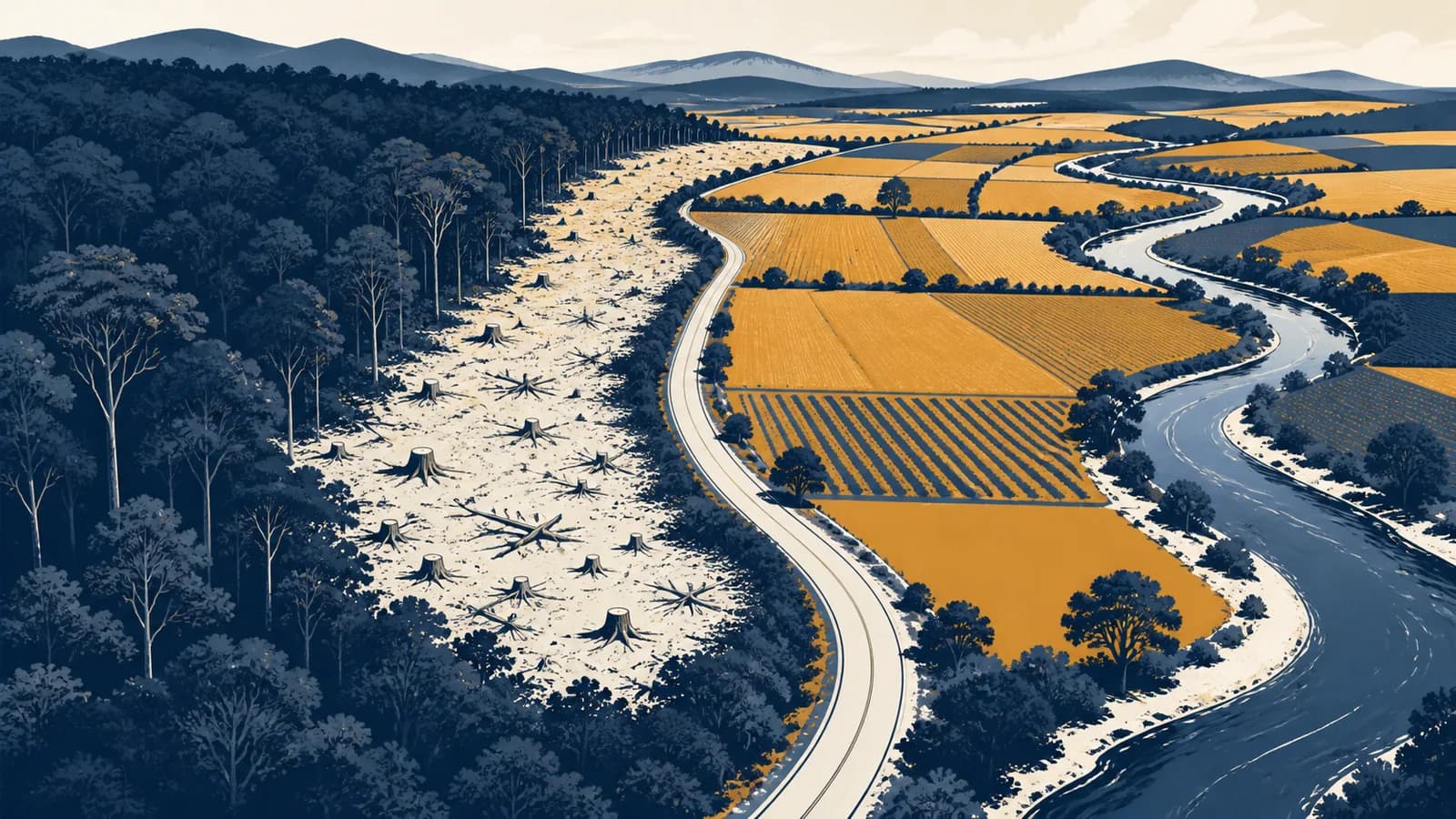
Deforestation is a land-use change that converts forest into non-forest land, in the context of environmental geography. In plain terms, it is the long-term removal of a forest so the land can become a field, pasture, mine, road, reservoir or settlement. The definition of deforestation matters because people need to distinguish permanent forest loss from temporary tree cutting, measure where conversion occurs, and connect distant demand for food and materials to changes on the ground. It also explains why deforestation causes habitat loss, releases stored carbon, alters water movement and changes the lives of people who use forests.
What deforestation actually is
Deforestation is the conversion of land classified as forest to a different land use, with no expectation that the forest will return in the normal course of management. The lasting change of use, rather than the sight of cut trees alone, defines the process.
A forest is more than a group of trees. It is land where trees form the main vegetation and where farming, buildings or other non-forest uses do not dominate. National definitions vary because dry woodland, young regrowth and tropical rainforest do not look alike. The Food and Agriculture Organization of the United Nations, or FAO, uses minimum thresholds for area, tree height and canopy cover so countries can report forest area consistently. Those thresholds are accounting tools, not a claim that every qualifying forest has the same ecological value.
Land use decides the category. A recently harvested timber plot that is expected to regrow can remain forest land. A cleared plot planted with soybeans has become agricultural land and counts as deforestation.
The distinction makes the term checkable. Imagine two neighbouring square plots. Workers remove mature trees from both. On Plot A, they protect seedlings and plan another timber harvest after regrowth. On Plot B, they remove stumps, sow grass and keep cattle there. Both plots lose tree cover at first, but only Plot B has clearly changed from forest to non-forest use.
Deforestation can be deliberate, as when a company clears land for a plantation. It can also emerge through repeated pressures. Frequent fire, grazing and fuelwood removal may prevent young trees from replacing old ones until the site no longer functions or qualifies as forest. The final map change can therefore be the end of a long process rather than one dramatic clearing event.
How forest conversion works
Forest conversion works through a chain of access, removal and continued non-forest use. A road or land claim makes a site reachable, valuable trees are removed, remaining vegetation is cleared, and farming, grazing or construction then prevents the forest from regenerating.
The first cause visible in an image is called a direct driver. Examples include cropland expansion, cattle pasture, mining, a road or urban building. Behind it sit underlying drivers: commodity prices, land rights, credit, tax rules, migration, enforcement and demand in consumer markets. A bulldozer is an agent of clearing, but it does not explain why clearing became profitable or permitted.
A new road, logging track or river route lowers the cost of reaching land and carrying products out.
Operators may sell valuable timber first. This can help pay for later clearing even when timber was not the final purpose.
Machines or fire remove smaller trees and undergrowth so crops, grass, buildings or extraction equipment can occupy the site.
Planting, grazing, paving or repeated burning suppresses regrowth and makes the conversion lasting.
The sequence differs by place. A large plantation may be surveyed and cleared in one planned operation. A forest edge may instead retreat through many small fields. Mining can create a compact pit plus a much wider network of roads, worker settlements and supply areas. A dam removes forest inside its reservoir and may also bring new access around the shore.
FAO's Global Remote Sensing Survey for 2000 to 2018 found that agricultural expansion accounted for almost 90 percent of global deforestation during the study period. The result does not mean every farmer plays the same role. It shows that the new land use after clearing was most often cropland or livestock grazing, while the people, markets and policies behind each conversion varied.
Deforestation versus forest degradation
Deforestation changes forest into non-forest land, while forest degradation leaves the land classified as forest but reduces its condition, biomass or ecological function. A forest can lose large trees, wildlife and resilience without crossing the formal boundary into a new land-use category.
Forest is converted to a field, pasture, mine, reservoir, road or settlement. The land-use category changes and forest recovery is not expected under current management.
The site remains forest land, but logging, fire, grazing, pests or fragmentation reduce tree cover, carbon storage, habitat quality or the supply of forest products.
The two processes often connect. Selective logging removes particular trees and opens tracks through the canopy. On its own, that is usually degradation. The tracks may later give farmers, miners or land speculators access. If they clear the remaining forest and establish another use, degradation has become a step toward deforestation.
Tree-cover loss is different again. It is an observation that trees disappeared from a mapped area during a period. Satellite systems can detect loss caused by timber harvest, fire, storm damage, plantation rotation or permanent conversion. They cannot classify every detected patch as deforestation without information about what happens next. A harvested tree plantation can produce a sharp tree-cover-loss signal even though it is replanted. A slowly thinning natural forest may suffer serious degradation without producing one obvious clearing signal.
These differences affect headlines and maps. Gross deforestation adds every area that changed from forest to another use. Net forest change subtracts gains through natural expansion or planted forests from losses. A country could report little net change while losing natural forest in one region and gaining commercial plantations elsewhere. The areas may balance in an account, but their species, soils and benefits to local communities do not become interchangeable.
How fire works as a driver of deforestation
Fire becomes a driver of deforestation when damage is lasting, repeated burning prevents recovery, or people convert burned land to agriculture, pasture or construction. Not every forest fire qualifies because many burned forests can regenerate and remain in forest use.
Some ecosystems have species adapted to periodic fire. Other forests are so moist that severe fire is unusual and highly damaging. The outcome depends on fire intensity, frequency, weather, surviving seed sources and what people do afterward. A satellite image of a burn scar shows disturbance. Later images and field evidence show if trees return or a new land use takes over.
Fire can also create feedback. Clearing dries vegetation along exposed edges. Roads bring more ignition sources. A first fire kills trees, leaving fuel for another. Repeated fires make regeneration harder, and grasses suited to burning may spread. In this case, human land use and drought can turn what looks like a single natural hazard into a continuing conversion process.
How deforestation changes water, soil and climate
Deforestation alters water, soil and climate by removing a living canopy and root network. Rain then reaches the ground differently, less water returns to the air through plants, exposed soil erodes more easily, and carbon stored in vegetation can enter the atmosphere.
Leaves intercept rain. Some water evaporates from their surfaces, some drips gradually to the ground, and roots create channels through which water can enter soil. Trees also draw water from the soil and release water vapour through their leaves, a process called transpiration. When trees are removed, these flows change. More rainfall may become rapid surface runoff, especially if machinery compacts the soil or fire leaves it bare.
If a catchment receives 1,000 units of precipitation, sends 450 away as runoff and 500 back through evaporation and transpiration, storage rises by 50 units: 1,000 = 450 + 500 + 50.
In the equation, P is precipitation, Q is water leaving as streamflow or runoff, ET is evaporation plus transpiration, and change in S is the change in stored water. Removing forest often reduces transpiration at the cleared site and can increase near-term runoff, but the exact result depends on rainfall, soil, slope, season and the replacement land cover. At larger scales, reduced moisture recycling can also affect where rain falls. This is why forest loss and how water scarcity develops across a region can be connected without being identical problems.
Soil is protected by litter, roots and shade. After clearing, raindrops can strike bare ground directly and break apart soil aggregates. Flowing water then carries fine particles downhill. Nutrients may leave with the sediment, and streams or reservoirs can fill with silt. Smoke and ash can add a brief pulse of nutrients, but repeated burning and erosion can reduce long-term fertility. Farmers may then need more land or more inputs to maintain production.
Forests store carbon in trunks, branches, roots, dead wood and soil. Clearing shifts some of that carbon. Fire releases carbon dioxide quickly. Unburned wood releases it over time as it decays, unless carbon remains stored in a long-lived product. Soil disturbance can also accelerate decomposition. The replacement crop may absorb carbon as it grows, but a field or pasture usually holds less carbon than the mature forest it replaced. This land-use mechanism forms one part of the causes and effects of climate change.
Habitat change is equally physical. Clearing removes nesting sites, food and shade. Roads and fields divide remaining forest into smaller patches. Edges receive more wind, heat and light than the forest interior, so an apparently intact patch can change near its boundary. Species that cannot cross open ground become isolated, while hunters, fire and invasive species may gain easier access. The effect is especially serious where many range-restricted species share the same threatened region, a pattern explained by how biodiversity hotspots are identified.
How deforestation is measured
Deforestation is measured by comparing forest extent at different dates and deciding which losses became non-forest land. Satellites provide repeated images, field surveys identify land use and forest condition, and national inventories combine those observations under a stated forest definition.
A satellite sensor records reflected or emitted energy from Earth. Healthy leaves, bare soil, water and built surfaces return different patterns across visible and infrared wavelengths. Analysts classify pixels or interpret sample plots, then compare dates. Radar can add information through cloud cover, which is useful in wet tropical regions where optical images are often obscured.
A square was dark forest in a 2022 image and pale bare ground in 2023. That is evidence of tree-cover loss, not yet proof of deforestation. A 2024 image shows regular crop rows, and land records describe a farm. Together, the observations support classification as forest converted to cropland.
Measurement contains choices. Analysts must state the minimum mapped area, the canopy threshold, the date range and the treatment of plantations, temporary clearings and burned land. A coarse map may miss a narrow road or many tiny fields. A short time series may mistake a harvest cycle for permanent conversion. Cloud, smoke and shadows can also hide the surface.
If 600 hectares are cleared from 20,000 starting hectares over 3 years, the simple annualized rate is 600 divided by 60,000, or 1 percent per year.
This calculation is useful for a transparent classroom comparison, but professional forest-change models can account for compounding and changing forest area. Area is also only one measure. Carbon accounting estimates biomass and soil changes. Fragmentation analysis measures patch size, edges and connections. Biodiversity surveys record which species remain. A complete assessment therefore asks both how much forest changed category and what qualities were lost.
How deforestation shows up in farms and supply chains
Deforestation appears in supply chains when forest is cleared to produce a traded crop, animal product, mineral or piece of infrastructure. The final buyer may be far from the clearing, so firms trace products back through processors and traders to farms or extraction sites.
A supply chain links land to a finished product. Cattle may move between several properties before slaughter. Soybeans from many farms may enter one storage silo. Palm fruit is processed quickly near plantations and the oil can enter many foods and household products. Timber from different concessions can pass through a mill. At each mixing point, the connection between a product and one plot becomes harder to see.
Traceability tries to preserve that connection. A farm boundary can be compared with dated forest maps. Purchase records can link a shipment to a supplier. Certification or independent audits can check practices. None of these methods works automatically. A trader may know the direct supplier but not the farm that supplied that supplier. A product can also be legal under local law yet still come from recent forest conversion, depending on the rule being applied.
The geography of demand matters because the benefits and costs occur in different places. A consumer gets food, furniture or a metal-containing device. A producer gets income and a government may get taxes or export earnings. Near the clearing, people may gain a road or jobs, while others lose access to forest foods, clean water or culturally important places. Evaluating the land-use decision requires naming those groups instead of treating “the economy” or “the environment” as single actors.
A useful buying question is therefore specific: can the seller identify the production area and the date after which forest conversion is not accepted? Labels can help, but a vague green claim does not establish traceability. For governments and companies, the same question becomes a data task involving farm coordinates, ownership records, satellite evidence and a process for correcting errors.
How deforestation shows up in law, money and planning
Deforestation becomes a legal and financial issue through land titles, permits, protected areas, lending rules, insurance and trade requirements. Decisions made in an office can raise or lower the reward for clearing, even though the physical change occurs at a forest edge.
Land rights shape incentives. A community with secure rights may be able to exclude outsiders and manage harvests over decades. Unclear or conflicting claims can reward whoever clears first and then argues that visible use proves possession. Rules can also conflict: one agency may protect forest while another funds a road, mine or agricultural settlement in the same area.
Planning changes the map before construction begins. A road route determines which land becomes accessible. A zoning plan decides where farms, housing or protected corridors may expand. An environmental impact assessment estimates effects and considers alternatives. Good planning examines indirect effects as well as the road surface or mine pit, since new access can trigger settlement and secondary clearing far beyond the project boundary.
The proposed collateral overlaps a recently cleared forest patch. The bank checks the title, clearing permit, protected-area boundary and its own lending policy. A loan that ignores those records can finance illegal conversion and expose the bank to repayment, legal and reputation risks.
Public policy can pay for enforcement, recognize community tenure, remove incentives that favour clearing, or reward conservation. International climate programs use the name REDD+ for efforts concerning reduced emissions from deforestation and forest degradation, conservation, sustainable forest management and enhanced forest carbon stocks in developing countries. The difficult part is establishing a credible reference level, measuring change, preventing displacement and ensuring that local rights are respected.
Leakage occurs when protecting one area shifts clearing elsewhere rather than reducing it overall. Additionality asks if a claimed result happened because of the policy or would have occurred anyway. Permanence asks if stored carbon and forest cover will last. These ideas matter to conservation payments and carbon claims because a protected patch is not a genuine climate gain if the same clearing simply moves across a boundary.
Can trees be harvested without deforestation?
Trees can be harvested without deforestation if the land remains in forest use and enough regeneration occurs to restore tree cover. The answer depends on the harvest method, recovery period and future land use, not simply on the presence of chainsaws or stumps.
Selective logging removes chosen trees while leaving much of the canopy. Clear-cutting removes most or all trees in a block. Either method can remain forestry if regrowth is expected, although their ecological effects differ greatly. Heavy machinery can compact soil, roads can fragment habitat, and removal of old trees can reduce nesting sites even if the legal land category remains forest.
Forestry becomes deforestation when the recovery cycle is broken. If a harvested site is ploughed for crops, maintained as pasture or built over, the land use has changed. It can also cross the boundary through repeated damage that prevents regeneration. The label “sustainable timber” therefore requires more than planting seedlings. It involves harvest levels, soil protection, species composition, road design, worker practices and evidence that the forest persists over time.
A managed stand is harvested, young trees establish, and the site remains designated and used for forestry.
Trees are removed, the site becomes cattle pasture, and grazing or repeated burning stops forest regeneration.
This distinction should not be used to excuse degradation. A forest can remain on a land-use map yet lose much of its carbon, structural complexity and wildlife. Classification answers one question, “Did the land stop being forest?” Responsible management asks the further question, “What kind of forest remains, and what can it still do?”
Can planting trees reverse deforestation?
Planting or naturally regenerating trees can restore forest cover, but it does not instantly reverse every loss caused by deforestation. Recovery depends on location, species, soil, time, future protection and the ecological qualities of the forest that was removed.
Reforestation establishes forest again on land that was forested before. Afforestation establishes forest on land not recently forested. Natural regeneration allows seeds, roots and nearby vegetation to rebuild woodland with limited planting. These approaches can store carbon, stabilize soil and reconnect habitat, but their results are not interchangeable.
A mixed native forest may contain trees of different ages, dead wood, fungi and many layers of vegetation. A single-species plantation of evenly aged trees can supply timber and store carbon, but it normally provides a different habitat and responds differently to drought, pests and fire. Planting trees on a natural grassland can also damage an ecosystem adapted to open conditions. “More trees” is therefore not a complete land policy.
Grazing, repeated fire or cultivation stops, and surviving roots or nearby seed sources can begin recovery.
Vegetation can reduce exposed soil, while competition, drought and browsing determine which seedlings survive.
Canopy layers, larger trees and dead wood develop, but some features of an old forest may take much longer or may not return.
Avoiding loss and restoring damaged land should be compared honestly. Protection retains existing carbon and habitat now. Restoration builds benefits gradually and can fail if land rights, fire management or maintenance are ignored. Restoration is still valuable, especially where it reconnects fragments or protects water sources, but future planting is not a like-for-like substitute for clearing an established natural forest today.
Who causes deforestation, and who can stop it?
Deforestation has no single actor: landholders, companies, governments, investors and consumers can all influence it at different points. Effective responses match each actor to the decision they control, while protecting the rights and livelihoods of people who live in and near forests.
The person holding a tool may be responding to a landlord, employer, market price or insecure land claim. A company may buy from an intermediary without seeing the production plot. A government may ban clearing but fail to fund mapping, courts or field enforcement. Consumers affect demand, but they rarely have enough information to police a supply chain alone. Assigning all blame to one group hides the mechanism.
Stopping conversion can involve enforcing protected boundaries, securing Indigenous and community tenure, improving yields on suitable existing farmland, tracing commodities, changing infrastructure routes and removing subsidies that reward expansion into forest. Each action can create side effects. Higher farm productivity may spare land if expansion is constrained, but it can attract more investment and clearing if expansion remains profitable and unrestricted.
The takeaway: Ask four questions about any proposed solution: which clearing decision changes, who has authority to change it, how forest outcomes will be measured, and where the pressure might move next.
Fairness is part of effectiveness. Rules made without local participation can restrict people who depend on forests while leaving powerful drivers untouched. Secure rights, usable alternatives and transparent enforcement make long-term protection more plausible. The goal is not to treat a forest as empty land or to treat nearby people as obstacles. It is to make the ecological and social value of keeping forest visible in real decisions.
Four mistakes people make with deforestation
Most errors about deforestation come from confusing a visible event with a lasting land-use process. Four common mistakes are treating every felled tree as deforestation, trusting net totals alone, naming one universal cause, and assuming tree planting cancels any loss.
1. Every cut tree means deforestation
A cut tree is evidence of harvesting or disturbance, not enough evidence of land conversion. Check the intended land use and later regrowth. A forest managed for timber can lose canopy temporarily, while a lightly wooded site can be deforested if it is permanently converted.
2. A stable national total means no harmful loss
A net total can hide simultaneous changes. Natural forest may be cleared while plantations or regrowth expand elsewhere. Compare gross loss, gross gain, forest type, location and condition. Equal areas do not guarantee equal carbon stores, habitat or benefits to communities.
3. One cause explains every place
Agriculture dominates global conversion, but local chains differ. Cattle, crops, roads, mining, settlement and fire interact with land rights, prices and policy. Diagnose the direct driver and its underlying incentives in the specific region before choosing a response.
4. Planting anywhere cancels clearing somewhere else
Young trees take time to grow, restoration can fail, and a plantation is not an ecological copy of an old natural forest. Prevented loss and new growth should be counted separately, with attention to permanence, species, location and the previous ecosystem.
Forest change is geography in motion
Deforestation shows geography in motion because it connects land cover, climate, water, economies, law and unequal power across locations. Reading it well means following a change on one plot outward through a watershed, habitat network, supply chain and set of decisions.
A useful habit is to look at any forest-loss claim and identify its scale. At plot scale, ask what replaced the trees. At landscape scale, look for roads, edges, rivers and remaining corridors. At national scale, examine definitions and gross changes. At global scale, follow trade and finance without losing sight of local land rights.
The same habit applies across the wider set of geography concepts and case studies: locate the process, trace movement between places, compare scales, and ask who makes the decisions. On the next map, news report or product claim you meet, do not stop at a patch of missing green. Find the replacement land use, the chain that produced it and the evidence that tells temporary tree loss from deforestation.